Walking from Zermatt, Switzerland
21-27 June 2014
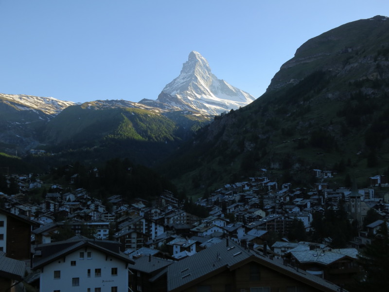
The view of Zermatt and the Matterhorn from our apartment - glorious.
Sunday
Our first walk of the holiday did not start full of promise: first,
owing to a misunderstanding in our host's directions, we took the wrong
route to the funicular station so adding a bit to our walk; second, the
intention was to take the funicular inside the mountain up to Sunnegga
(which worked well) and then the gondola to Blauherd, which didn't work
out as the timetable was confusing and the gondola wasn't open for
another couple of weeks.
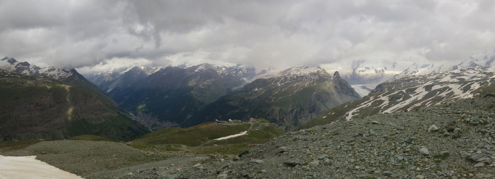
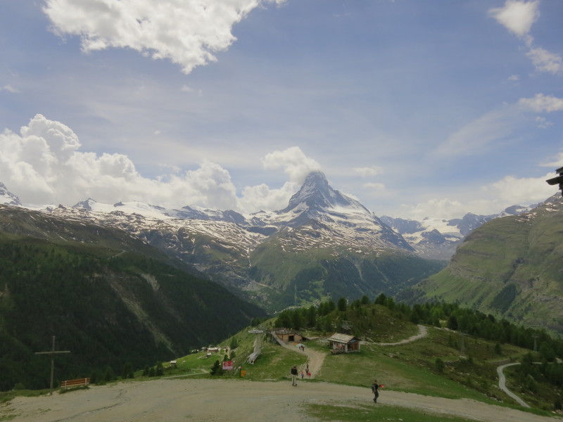
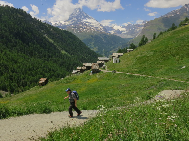
So the real start to our walk was the ascent from Sunnegga at 2288m to Blauherd at
2571m, largely following the route of the gondola towers and cables. The
going is quite hard at this altitude, and so we took our time, but there
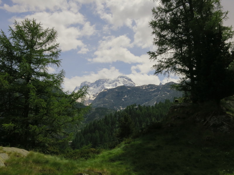
were rewarding views back across the valleys including to the Matterhorn
seen here with its head in the cloud

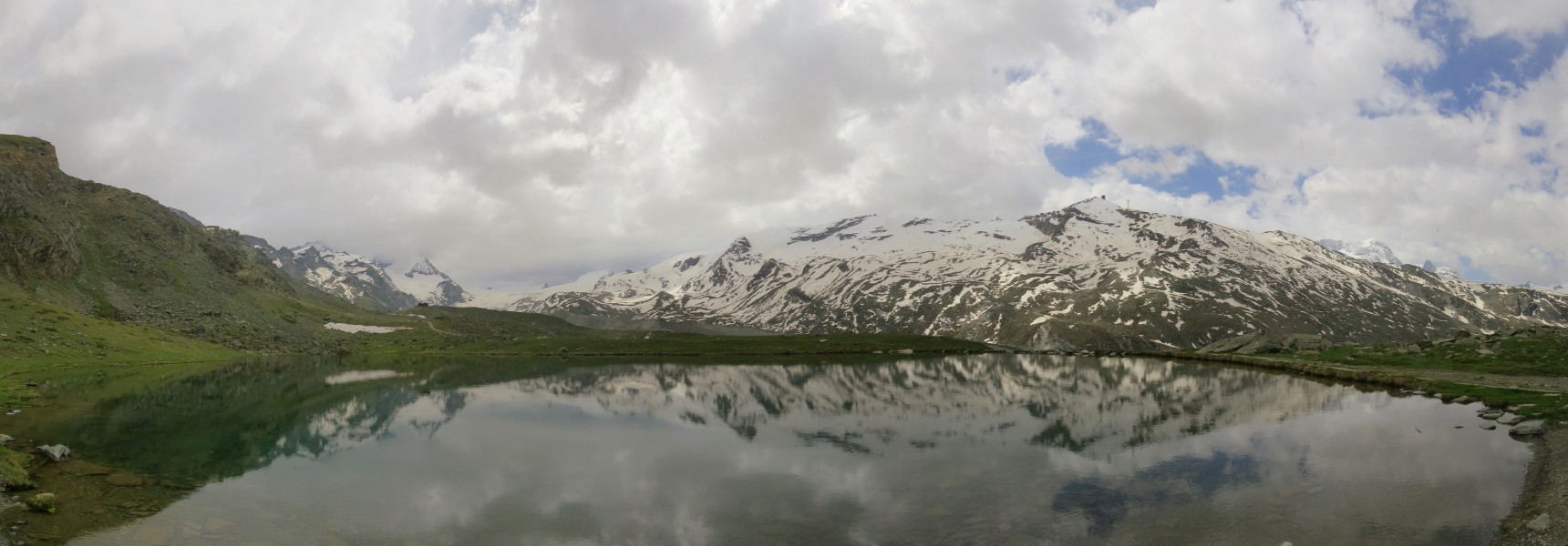
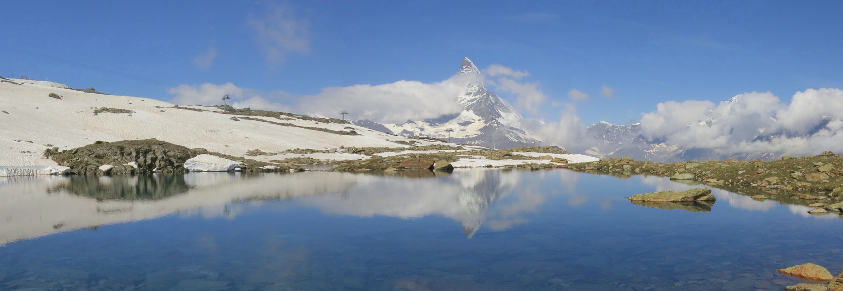
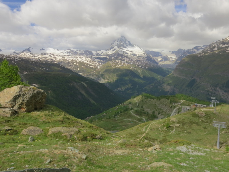
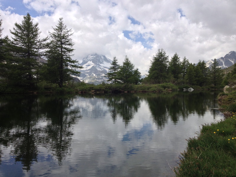
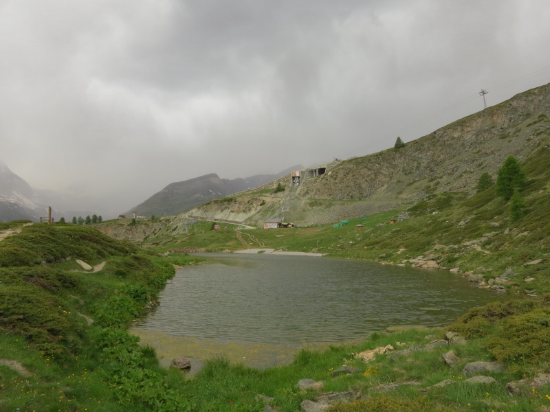
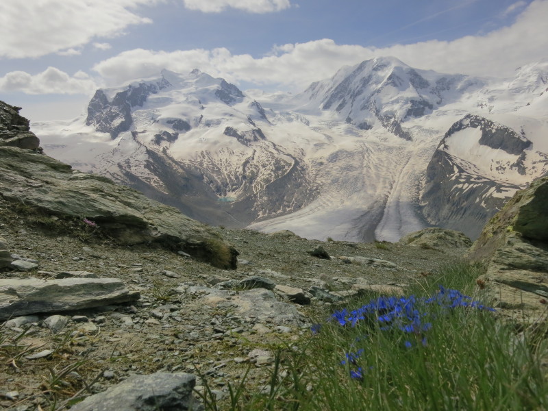
Our walk today was the "Five Lakes Walk" and
this is Stellisee, first of the lakes. Later in the week we will descend
that slope from Gornergrat into the valley between the lake and the
mountain
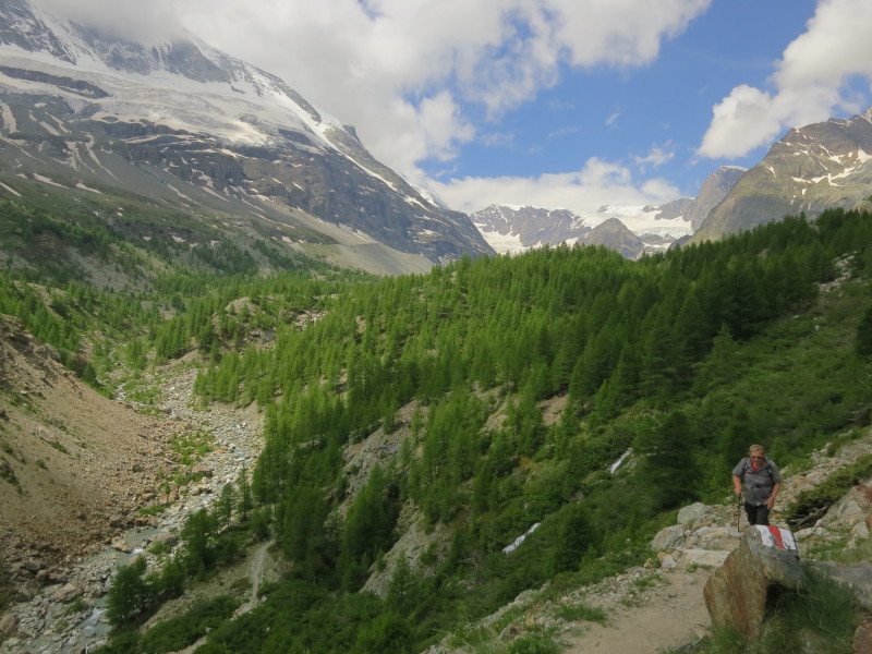
Crossing the valley
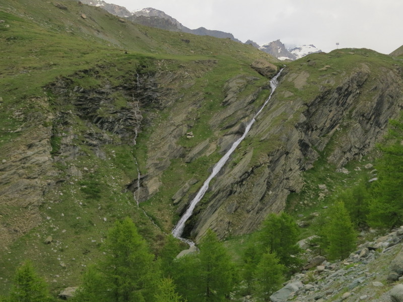
An impressive waterfall slides across the rock face as we make a
zigzagging descent
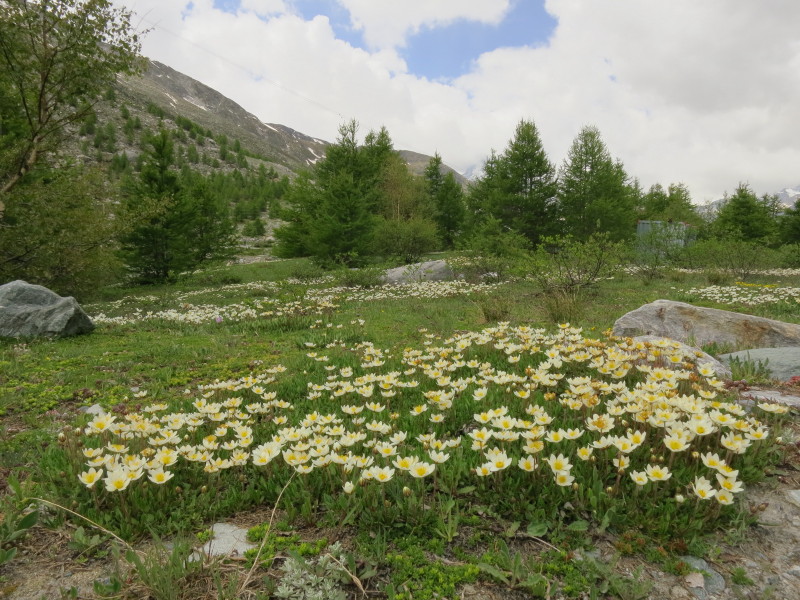
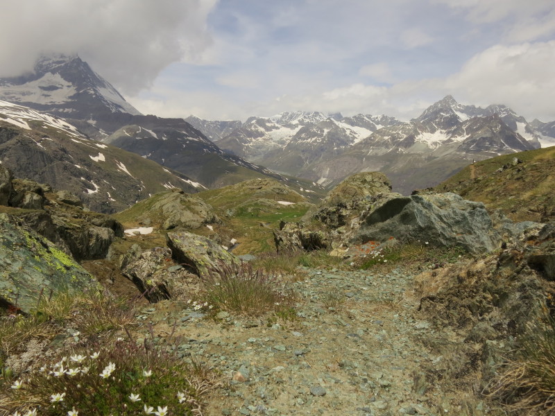
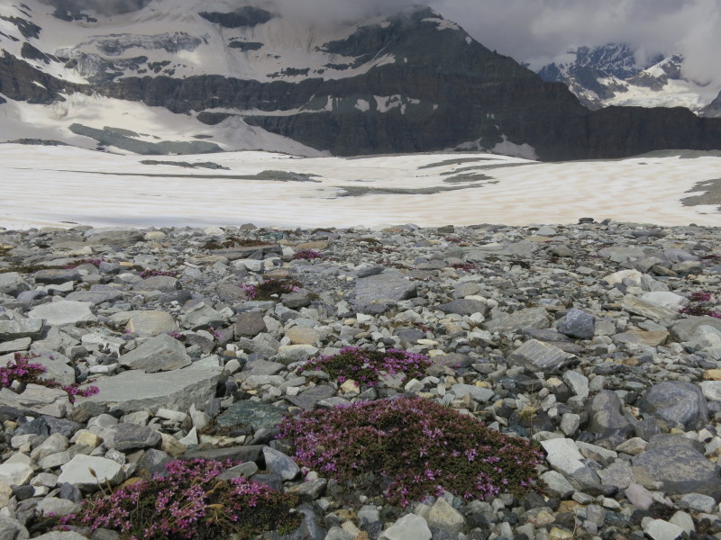
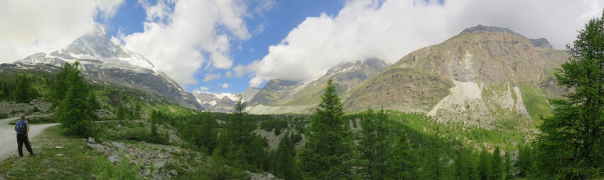
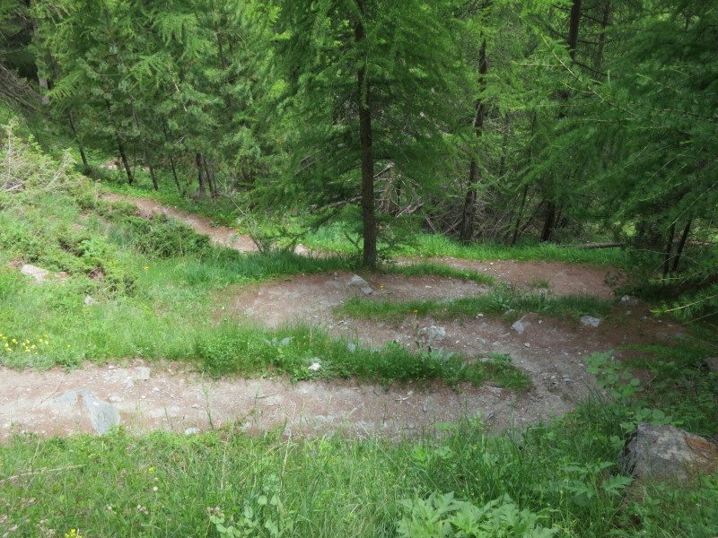
The walk is quite a mixture of almost desolate bare rock and soil, and
trees, grass and flowers
Grindjesee, second of five lakes on today's
walk, with the cloud-topped Matterhorn in the background
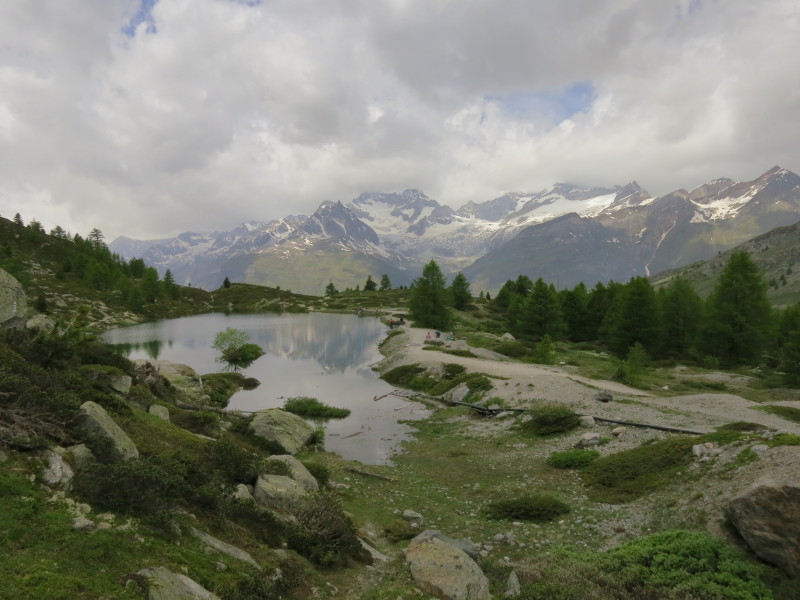
Having gained a little height on the other side
of the valley, we reach Grueensee, third of five lakes on today's walk
A fresh descent back into the valley and we reach
Mosjesee, fourth of five lakes on Sunday's
walk, after which it is all up back to Sunnegga, with Dad seen here climbing away from
the lake
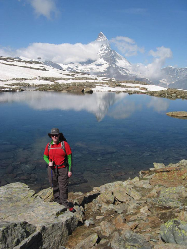
Leisee, the fifth of the five lakes on today's walk,
as thunder rolls around the high mountains. The conveniently located
little funicular takes us back up to Sunnegga
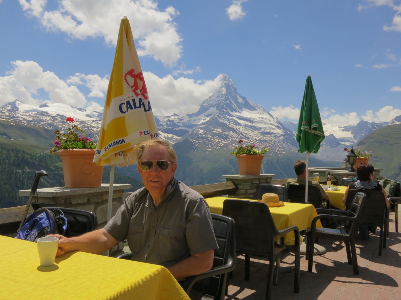
After the thunder, the skies clear very
rapidly, and we stop for a drink at the café with some wonderful views
before descending to Zermatt in the main funicular
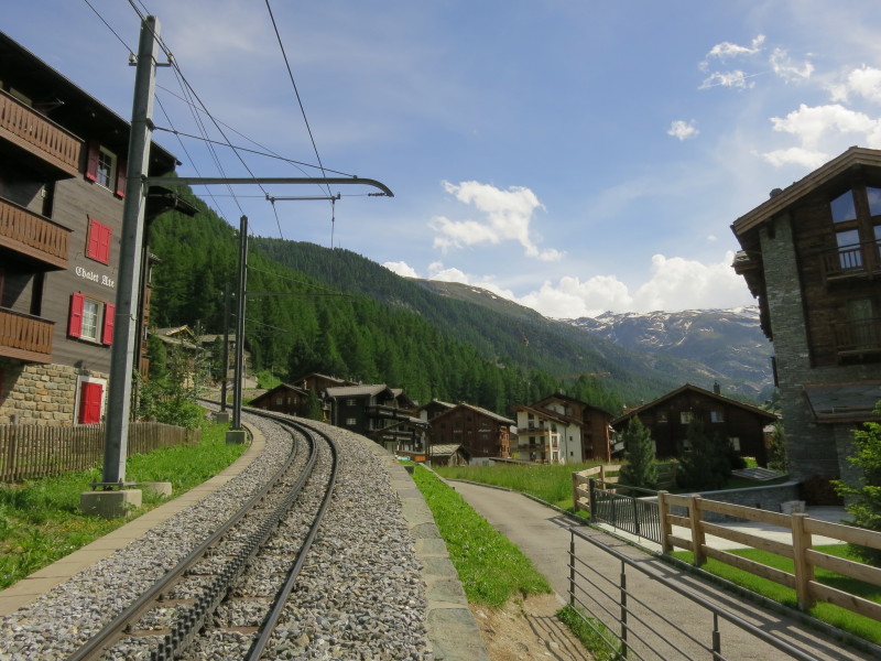
Walking across the Gornergratbahn on the way back up to our apartment
Monday
Our second walk of the holiday was a largely downhill walk, taking the Gornergratbahn cog railway from Zermatt at 1620 metres to Gornergrat station at 3089 metres, and then taking a looping route to walk down to the Riffelalp station at about 2220 metres. Although we expected some snow at the top
of the walk, we thought it wouldn't be problematic.
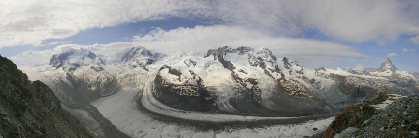
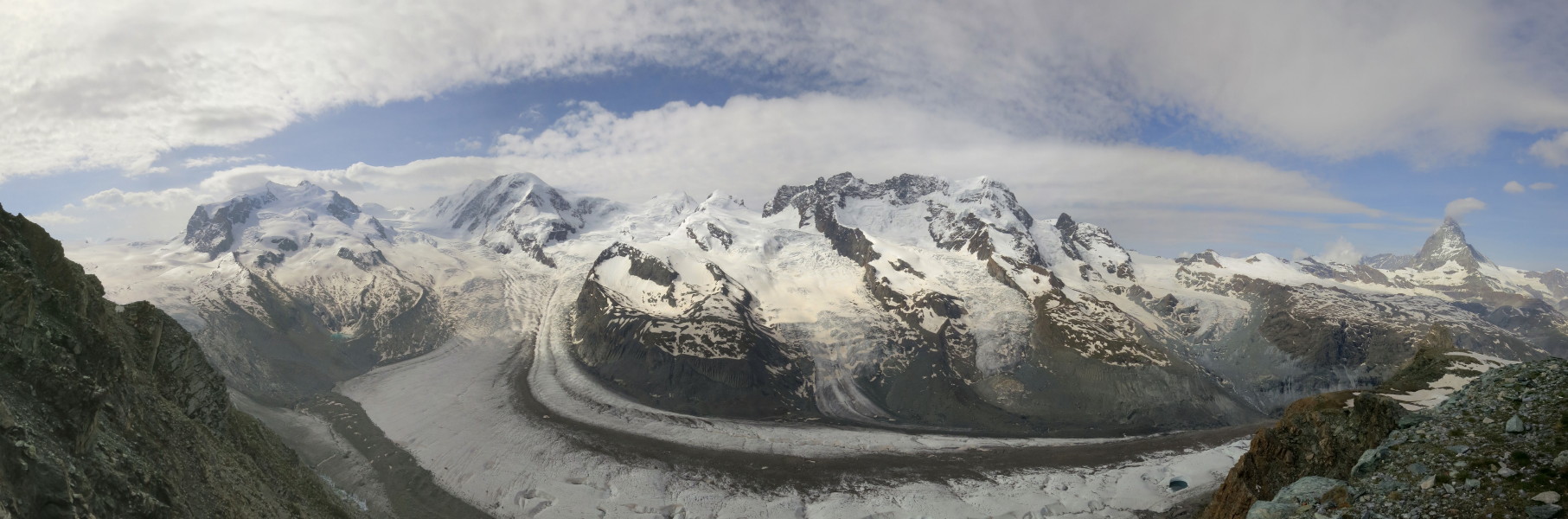
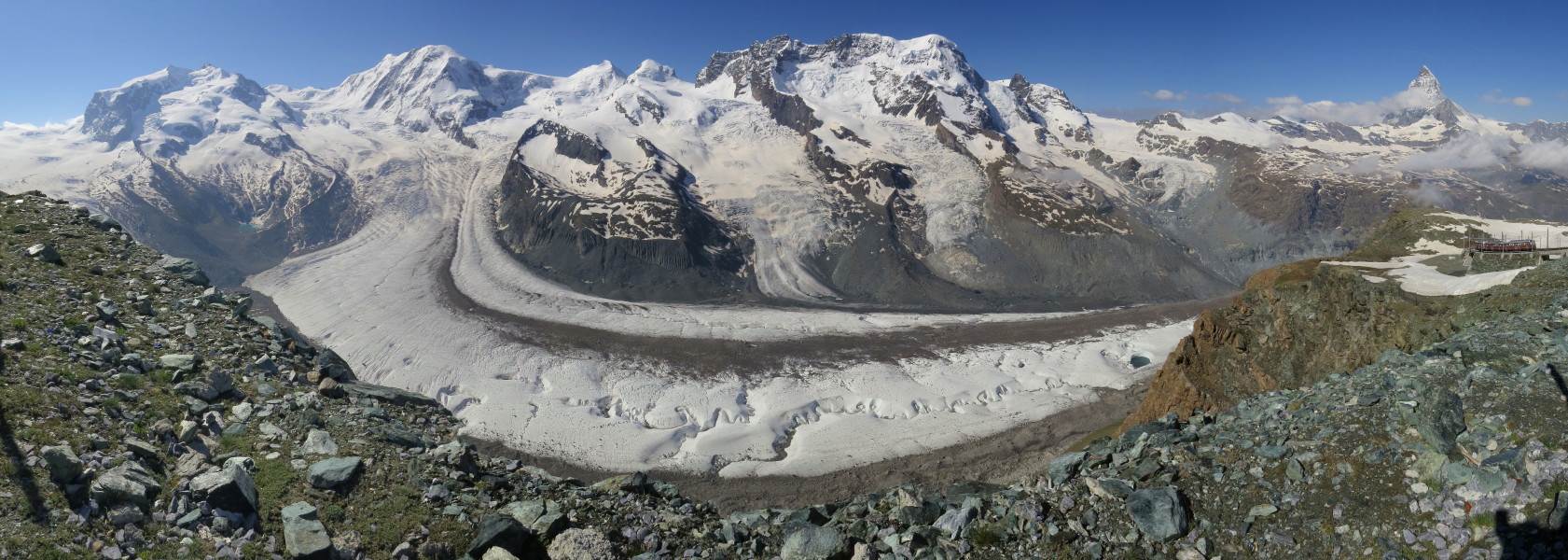
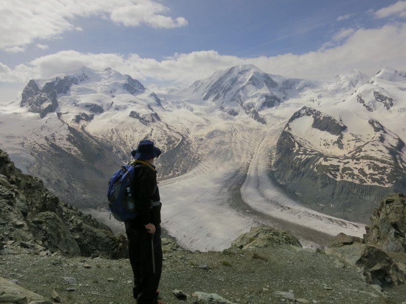
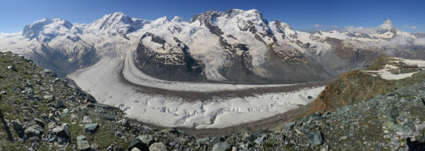
The Gornergletscher, the second-longest glacier
system in Europe, from the Gornergrat at the top of the Gornergratbahn
Before beginning the walk proper, we had a little exploration of the
facilities at the Gornergrat.
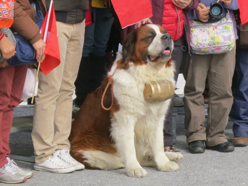
This photo was for Lucy - people were paying to have their photo taken
with the St Bernard dog, but I was too stingy.
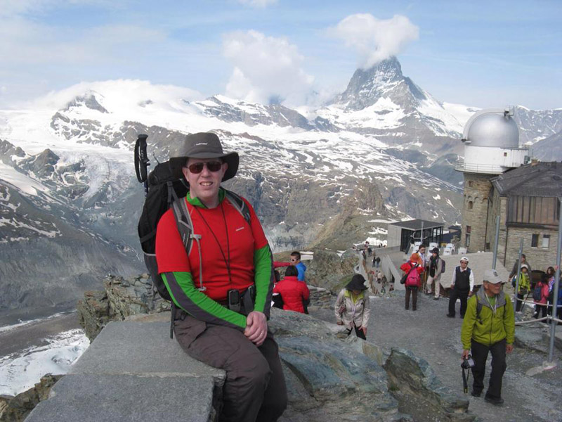
Exploring the busy top of the Gornergrat
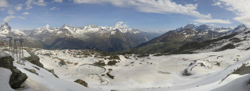
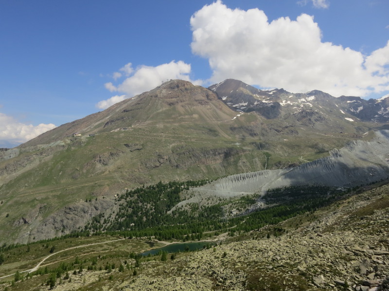
Looking the other way from the glacier - the
area in the middle distance on the right includes where we were on
Sunday. We will cross this area later in the week
From Gornergrat we walked down, with views of
the Gornetgletscher

Heading for the Riffelhorn (on the left), with
the railway descending. We're nearing Rotenboden station and have
crossed the majority of the snow we encountered - less than expected
The mountains around the Zmutt valley, from the
Matterhorn on the left. We will explore the Zmutt valley later in the
week.
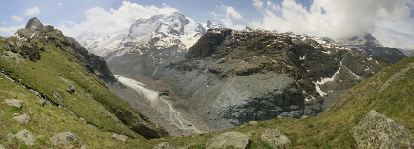
The foot of the Gornergletscher.
Since I first came to Switzerland, this glacier has retreated 800
metres, and the surface is much lower too - within living memory, the
surface was halfway up the valley walls. We've passed the Rifferhorn (on
the left) and continue to walk more or less on the edge of the valley as
it starts to curve around towards Zermatt.
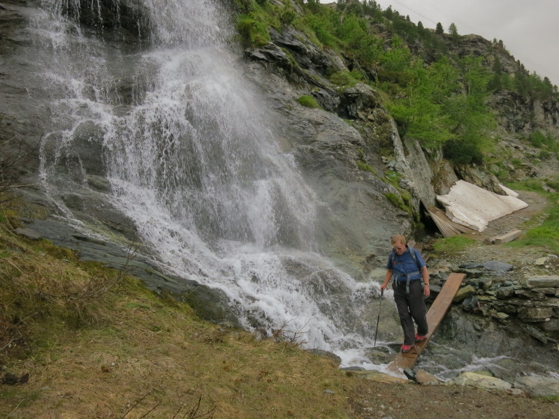
We thought we'd done all the awkward footwork
and had only a level walk back to the railway, but we'd reckoned without
the removed bridge. The plank was rather slippery so it was time to put
the spikes back on our boots to make sure of our footing.
The Riffelalp Resort hotel is the only one I
know of that has its own branch line and its own service to shuttle
residents from the main line, complete with its own turning circle and
engine shed. The platform (these two blocks to stand on) is understated,
though. From here it is a short walk along the branch line to the main
Riffelalp station, our timing being almost perfect as the afternoon
rains arrived. Tuesday
Our third walk began with a short ride on the Gornergratbahn
to Findelbach station, to gain a little height. I spent a little while seeing if
I could get into a position to photograph the waterfall which is an impressive
sight from the train as it crosses the high bridge below the station, but
without an unpermitted straying onto the line, it didn't seem possible. (The
Zermatt
website has a good photo - if I ever go back I will look to visit the north
bank of the side valley.)

After that, we made our way up the main valley, past the Furi gondola
and cable-car station. A view looking down the valley towards Zermatt
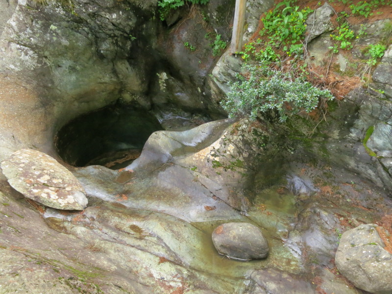
The "Glacier Garden" with the holes created by
strong flows underneath the glacier we saw yesterday
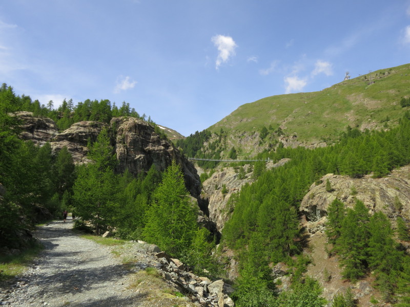
The suspension bridge that is our next
objective
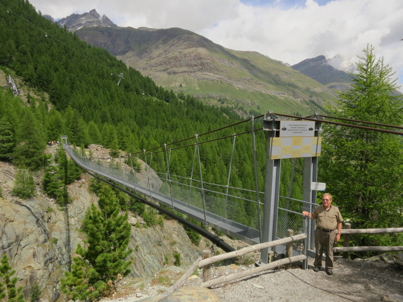
The bridge is 90 metres above the water below
Looking down the valley from the bridge, past the gondola station
buildings at Furi (about 1860 metres) to Zermatt (about 1620 metres).
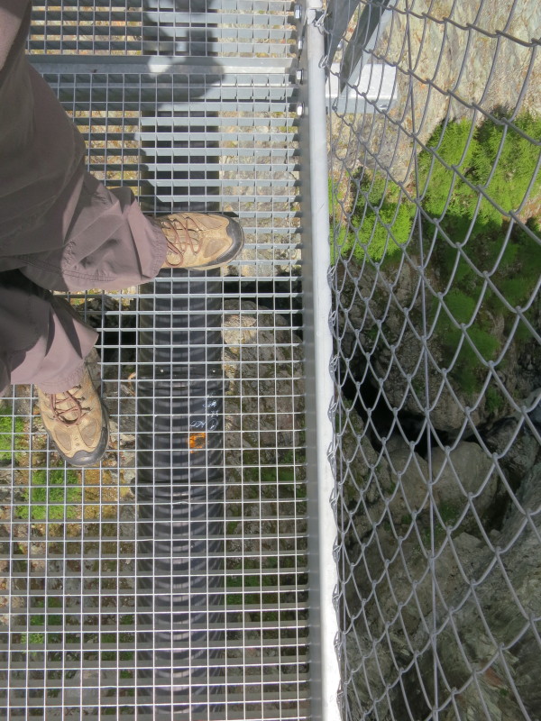
The bridge is an open grid
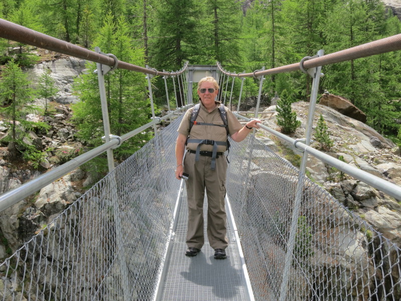
When walking, the bridge sets up an interesting
rhythm, twisting and swaying. Its official capacity is 125 people.
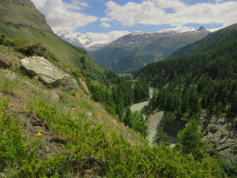
We walked down the west side of the valley past Furi, and descended from Furi towards Zermatt
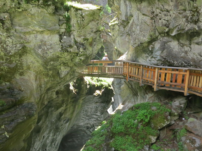
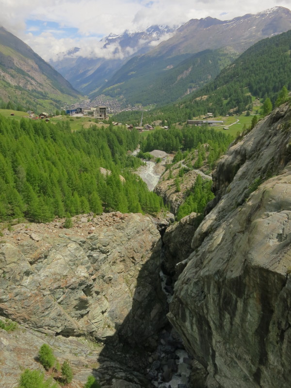
Our final objective of this walk was to explore the impressive Gorner Gorge
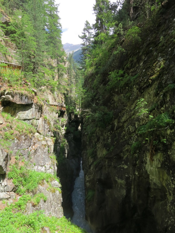
More galleries providing the walkway along the side of the gorge, high
above the foaming water. The walk then continued along the river down to
Zermatt. Wednesday
Our fourth outing began with a journey to the "Matterhorn
Glacier Paradise" which is the marketing name for the Klein Matternhorn.
The journey is a long gondola ride to Trockener Steg, and then a cable
car to the top. The cable car terminus is at 3820 metres, the highest in
Europe, after which there is an elevator up inside the mountain and then
a short flight of stairs to the viewing platform with its spectacular
views over the mountains of Switzerland and Italy.
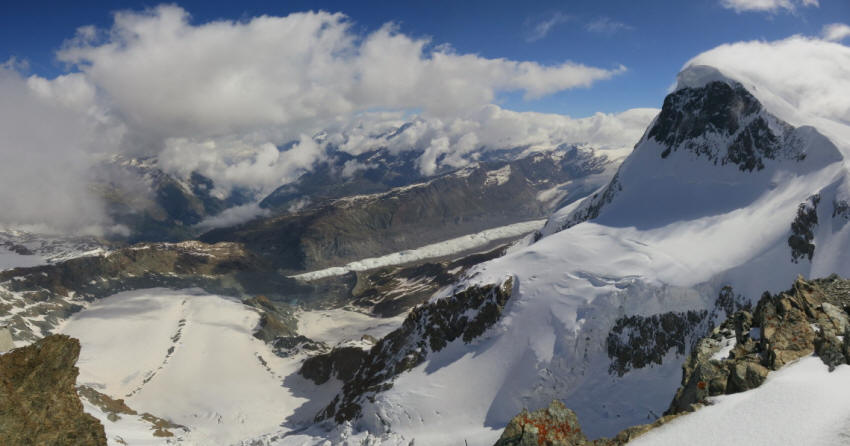
Breithorn (4164m) on the right from Klein
Matterhorn at 3883 metres
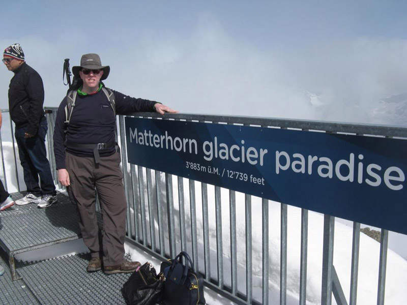
On the platform at the top
After the excursion to Klein Matterhorn, we returned by cable car to
Trockener Steg, and set off on our walk, feeling slightly out of place
as the cable car station is set up for skiers and stationary sightseers,
not walkers, and it was a bit of a challenge to get away from it. We
managed, however, and soon were in the midst of a mix of snowy and rocky
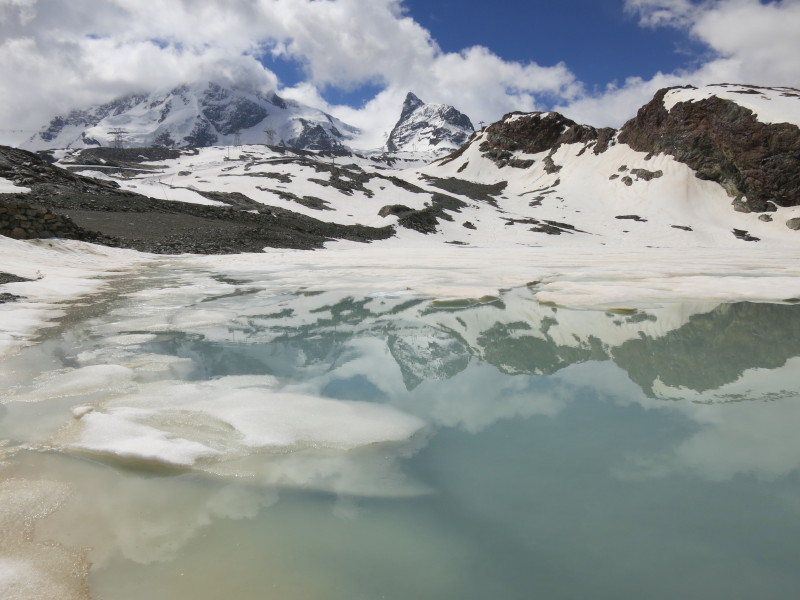
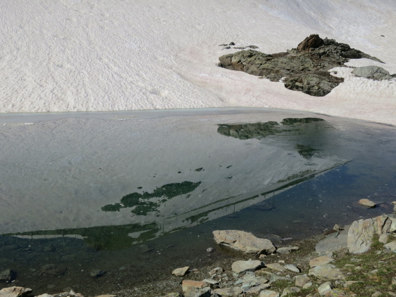
desolation. This is the reflection of Breithorn and Klein Matterhorn
(where the cable car goes to) in
the semi-frozen Theodulgletschersee
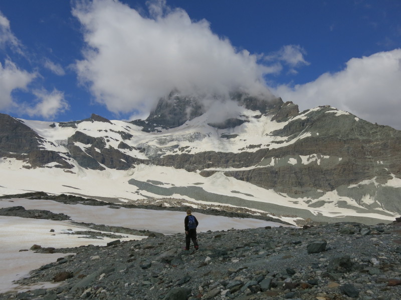
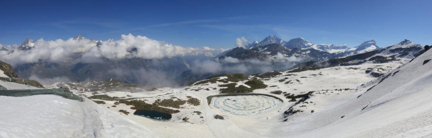
Having made our way around the Theodulgletschersee at around 2860
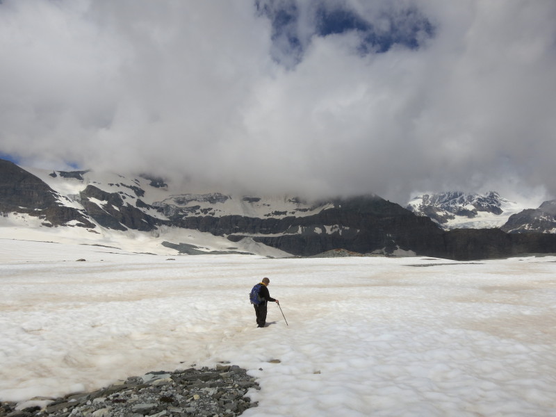
metres, we gained a little height and then began a long gentle descent across the Oberer Theodulgletscher
The official route, marked by flags, goes through that glacier meltwater so we found a safe alternative
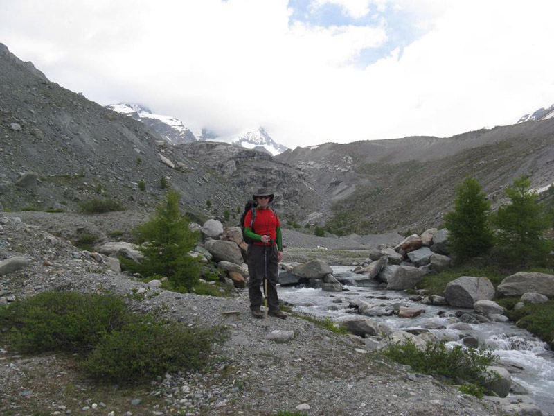
Heading across the foot of the Furgggletscher -
possibly the first time I've had occasion to use a word with three
consecutive Gs in it (unless you count "argggh")
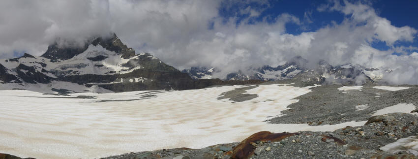
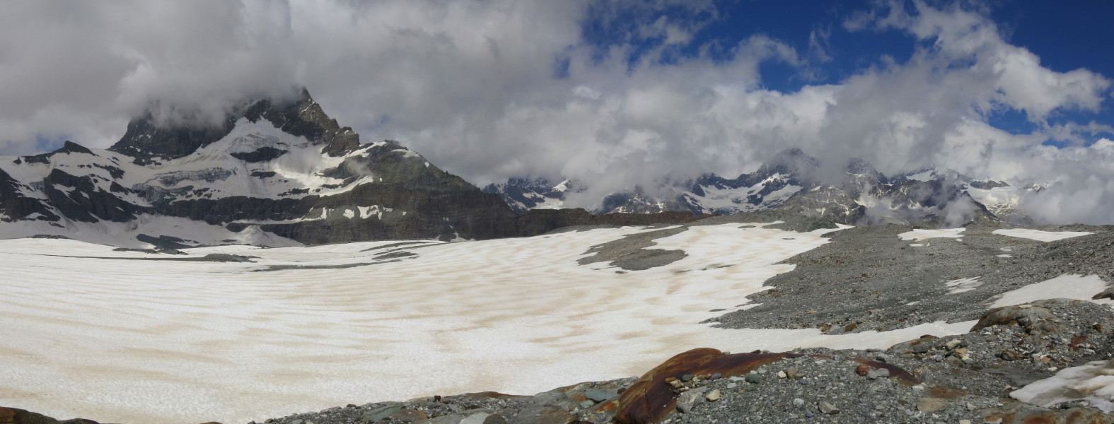
The Matterhorn kept its head in the clouds as we continued across the
foot of the glaciers towards the Furgg valley hidden in the middle
distance
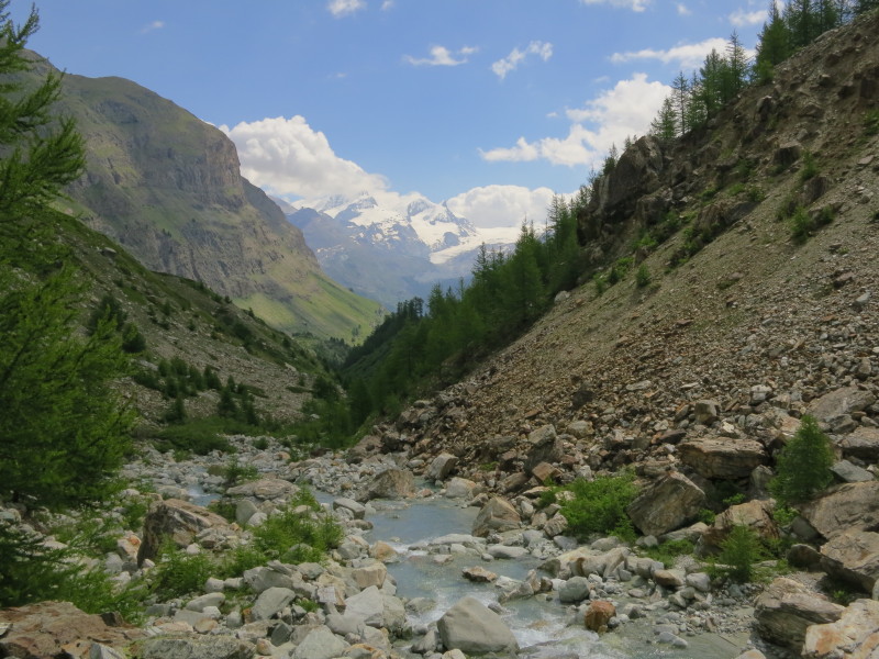
Heading down into the Furgg valley
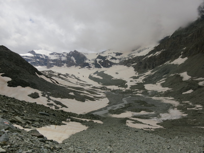
Having crossed the Furgg valley and river from the left of picture (from
behind the dark cliff) at about 2690 metres , we are now
climbing out the other side to a minor col at 2760 metres.

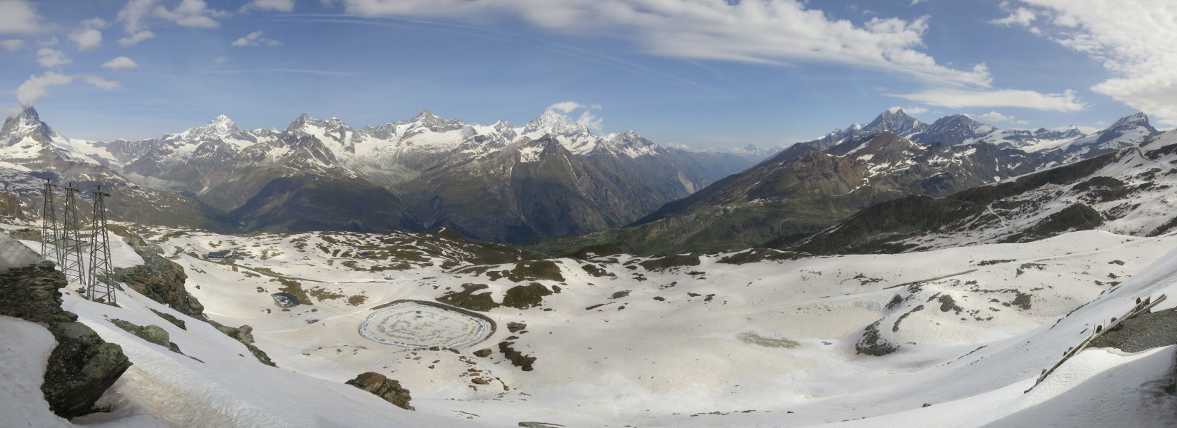
From that col, a look down to the gondola station at Schwarzsee, with Zermatt in the
valley on the left. Centre-right is the massif we explored on Monday,
with the rounded dome of the Riffelhorn, with part of the Gorner glacier
to its right. Just to the left of centre is the side valley whose five
lakes we explored on Sunday.
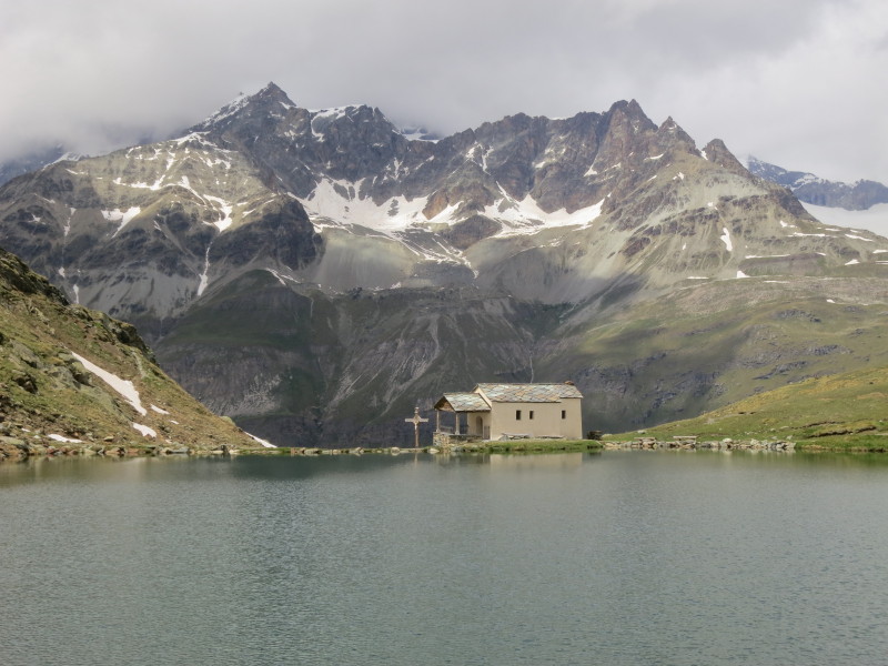
There then followed an easy descent to the lake of Schwarzee and the
iconic chapel at Schwarzsee, dedicated to Mary of the Snows. A gondola
ride should have taken us down via Furi to Zermatt, but the section from
Schwarzsee to Furi was temporarily closed, so they sent us up to
Trockener Steg again, to get the cable car back to Furi, but while we
were waiting at Trockener Steg, we were told that the gondola was
reopened and thus that the cable car downwards, which doesn't normally
run at this time of year, had been closed again, so it was back on the
gondola to Schwarzsee and then via Furi to Zermatt. Not really a problem
as the ride on the gondola is beautiful in its own right, but it was a
good job we weren't in a hurry. Thursday
Our fifth walk took us once again to the top of the
Gornergratbahn cog railway, from where we would descend northwards to
the Findel valley.
The Gornergletscher from Gornergrat - same view
as Monday but a better photo and better weather. (You can just see a
train on the far right, too.)
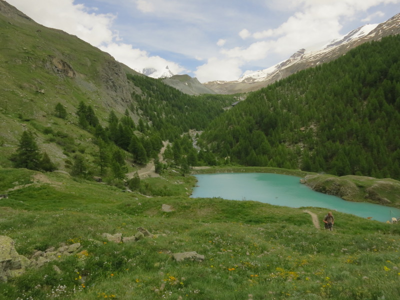
The start of our walk is past the unfrozen and
frozen lakes and crossing Kelle, eventually down into the Findel valley
hidden in the middle distance
An experiment that hasn't worked wonderfully -
that is a reflection of a Gornergratbahn train in the lake
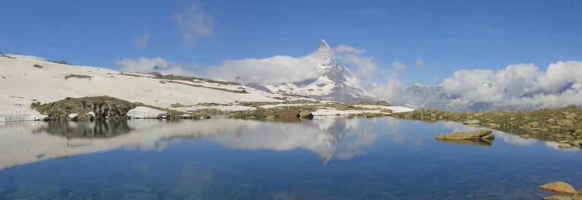
The Matterhorn reflected in what appears to be
an unnamed lake in the Kelle area
There was, predictably, more snow on today's walk on the north-facing
slopes from Gornergrat than on the west-facing slopes we travelled on
Monday, and it gave us a little difficulty in places. But now, having left most of the snow behind, the way
ahead is down into the valley, with one of the five lakes clearly
visible.
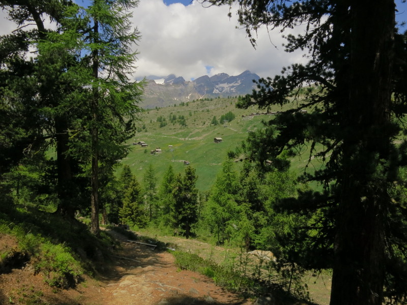
From open mountain-sides, the character changes
for a little while as we descend through the forest towards the river
Climbing back up after crossing the river, with the Matterhorn in the
background.
A well-earned cup of coffee at Sunnegga before we take the funicular
down inside the mountain to Zermatt. Friday
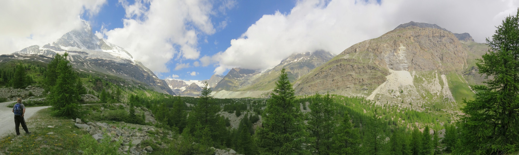
Our final walk of the holiday was an exploration of
the Zmutt valley
Looking up the Zmutt valley, with the north face of the Matterhorn on the left
Down the Zmutt valley towards some of our earlier walks
Having walked up the south side of the valley (left of picture), we are now descending the north side, albeit that at this point "descending" involves a stiff climb to circumvent a rockfall on the original path
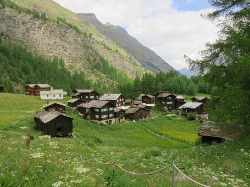
Looking down on the green reservoir in the Zmutt valley, which is part of the major water pumping and transfer systems that move a lot of water westwards
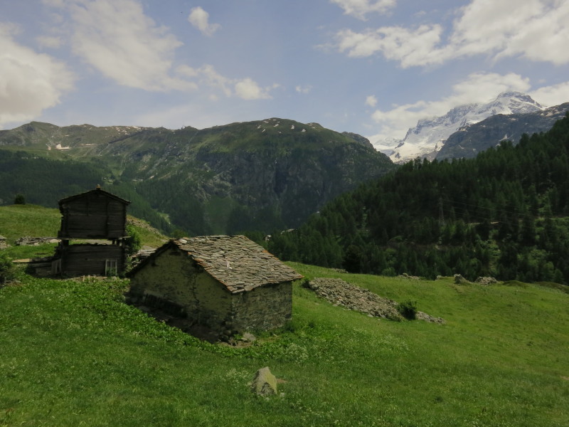
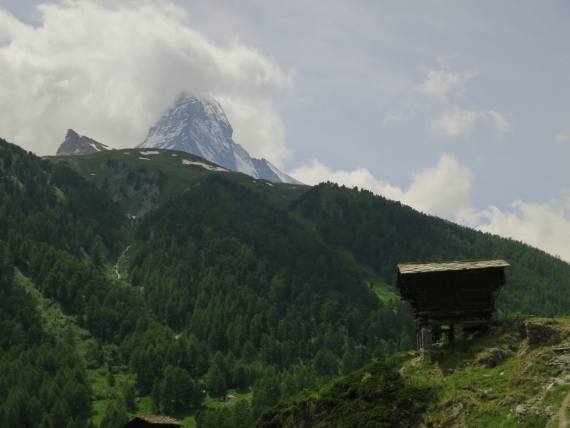
A somewhat precarious looking hut, and the Matterhorn
The Breithorn (4164m) is in the centre, with the Klein Matterhorn (3883m) which we visited just peeking out to its right
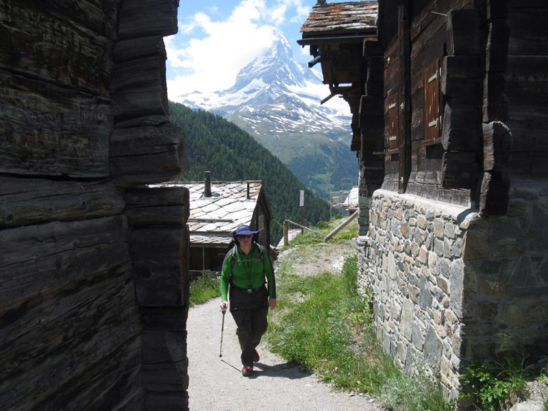
Descending towards Zermatt
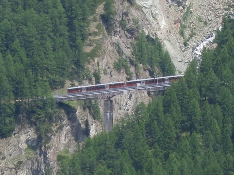
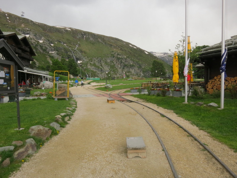
The Gornergratbahn mountain railway at Findelbach
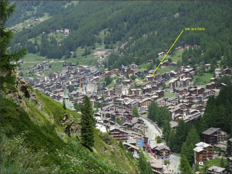
As we continue our descent towards Zermatt, on our last mountain walk of the holiday, there is a good view of the town.
Our apartment is the top floor of the marked building. It's a tiring little climb from the river after dinner!
|