Birmingham Canal Navigations Holiday
6-12 October 2012
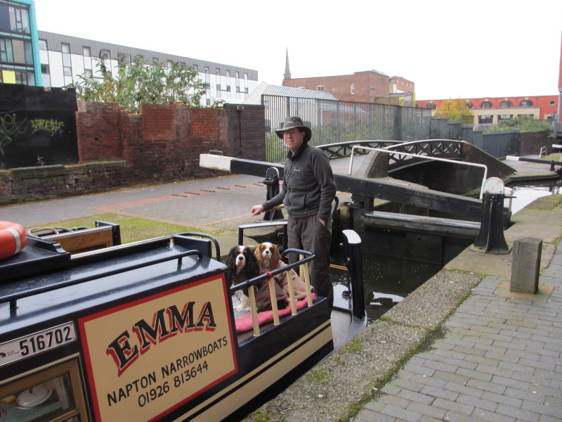
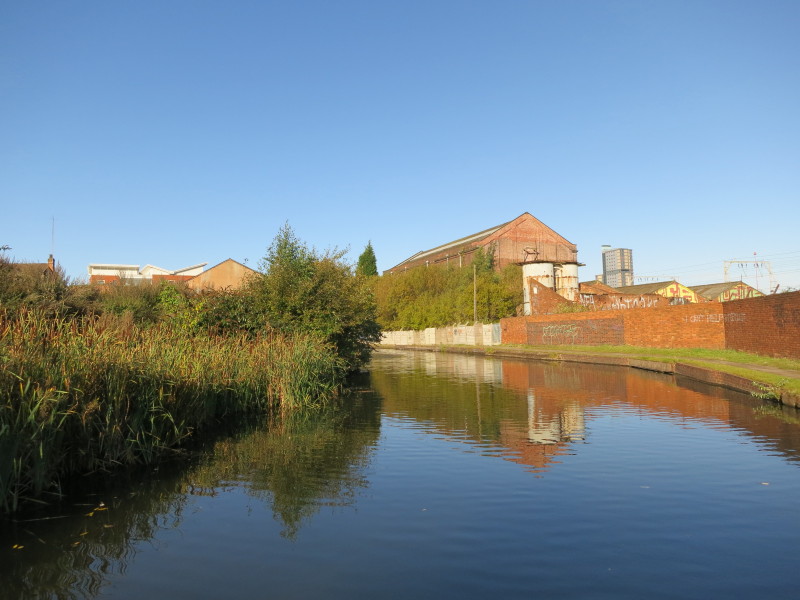
Saturday
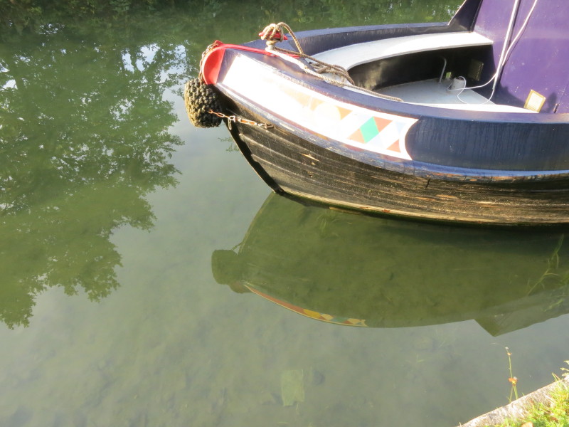
After picking up the boat at Autherley Junction, we took it backwards through
the stop lock there onto the Staffordshire and Worcestershire Canal for a short
distance to Aldersley Junction, where we turned up the Birmingham Canal,
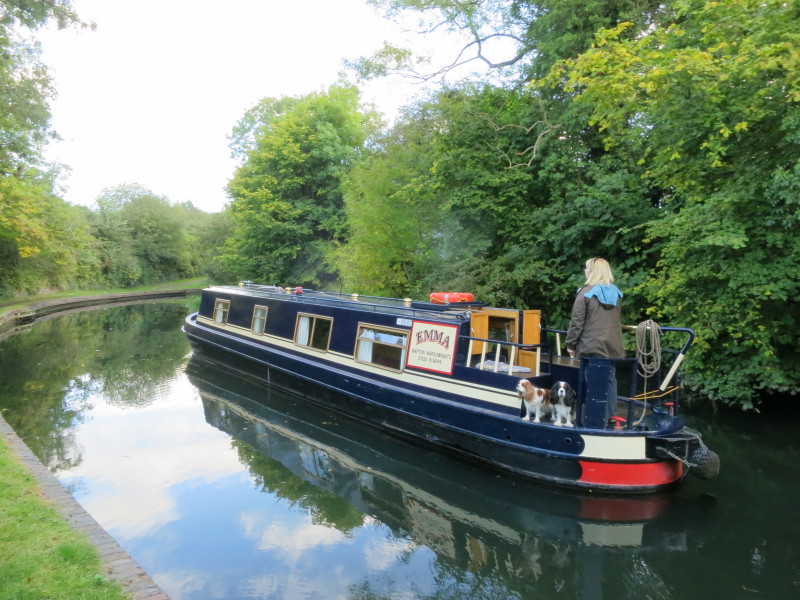
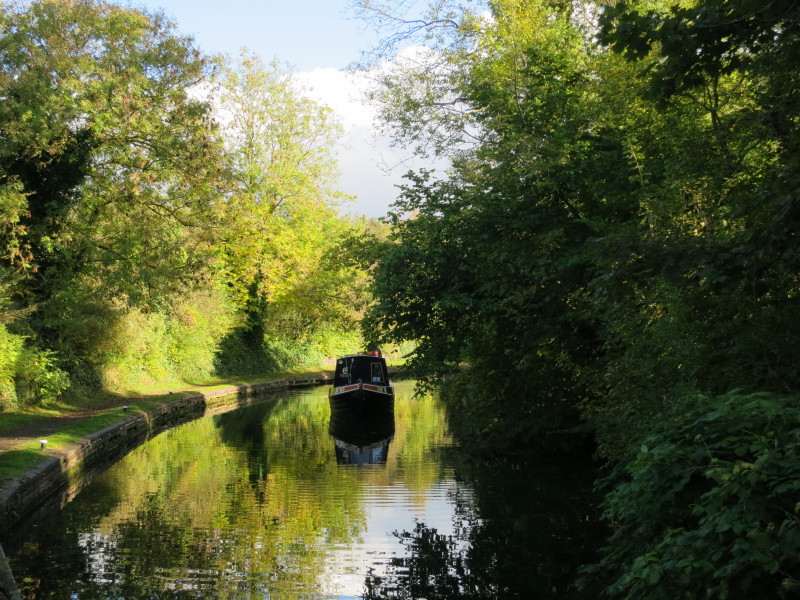
beginning our ascent of the 21 locks of the Wolverhampton flight. Here Lucy
steers the boat between locks as Hetty and Ellie watch the world closely.
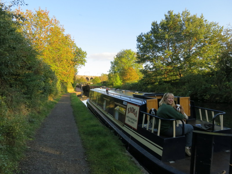
Our mooring spot for the night between locks 18 and 17. Not an ideal spot
because of worries about the local inhabitants, some of whom pulled out our
mooring spike at one point, but there wasn't time to go through all 21 locks on
Saturday afternoon, and realistic alternatives were to go in the wrong direction
at the start of our holiday, which didn't find favour.
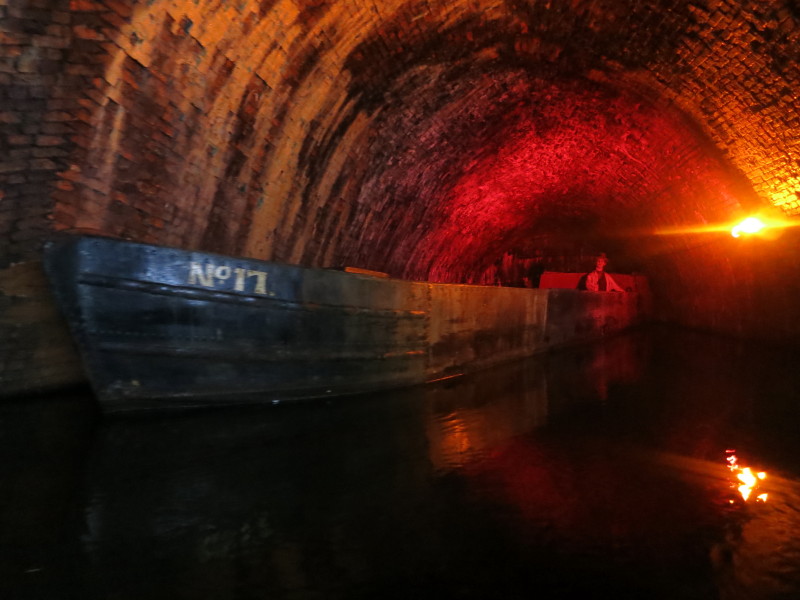
The view at night
Sunday
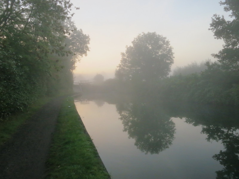
Next morning the same view, with mist obscuring the view ahead to the railway
viaduct
The water in this canal, and indeed those for the next few days, was remarkably
clear, showing clear views of the canal bottom right the way across.
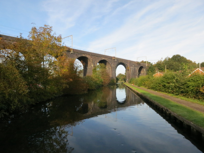
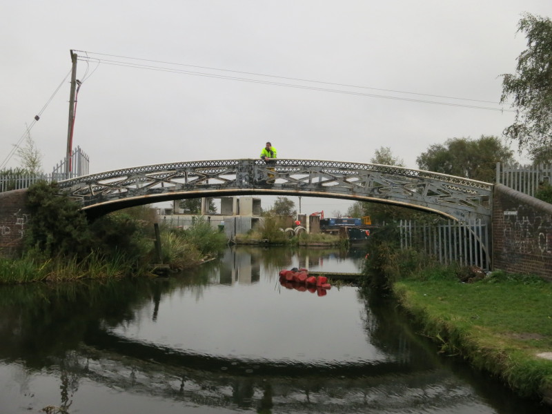
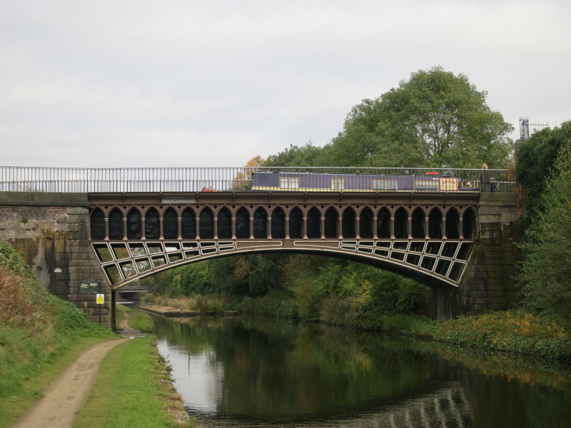
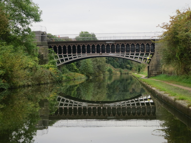
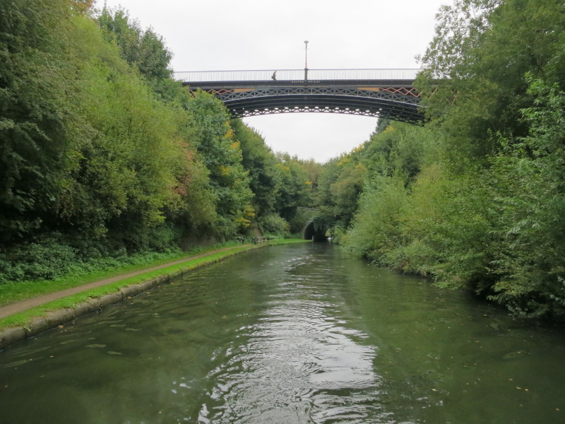
Safely through lock 17, a look back to the railway viaduct on the Wolverhampton
to Shrewsbury line. Note how all the arches are standard arches except the one
for the canal which is a skew arch, necessitating triangular infills either
side, one of which can be seen on the right. Immediately after this, as Lucy was
working lock 16, Hetty decided she couldn't bear to be parted from Lucy by the
width of the canal and jumped in. She then followed the boat into the lock and
proceeded to try to swim between the boat and the lock-side, a dangerous
undertaking. Stephen managed to get hold of her and haul her back onto the boat.
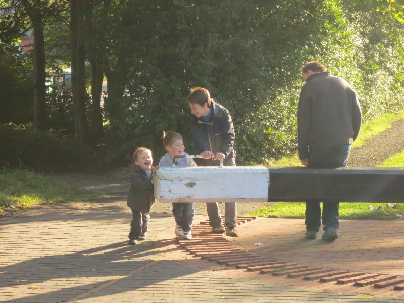
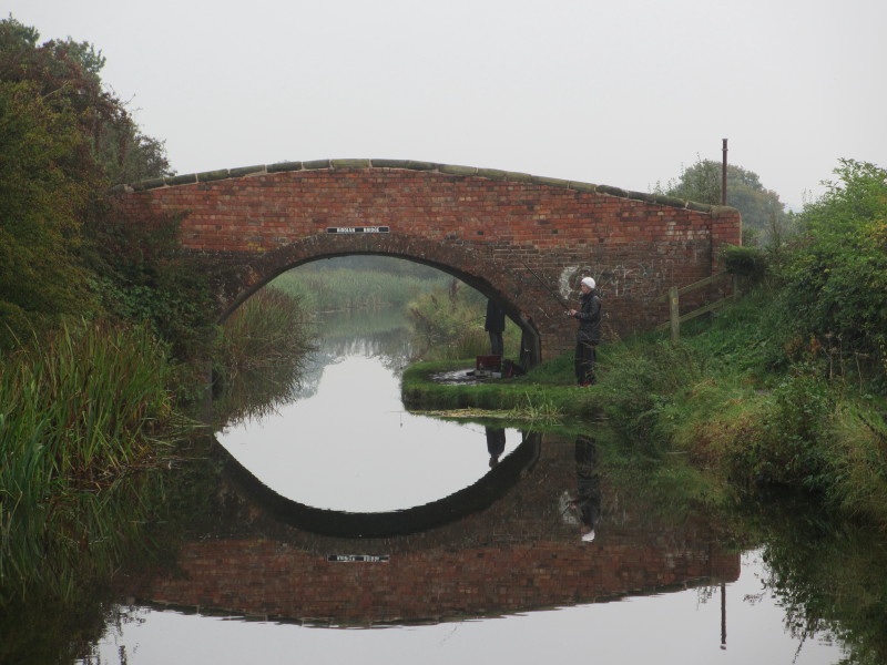
After that excitement, at lock 16 we were also joined by Thomas, Ben, Debbie and Mark
for the day, who here help open
the top gate.
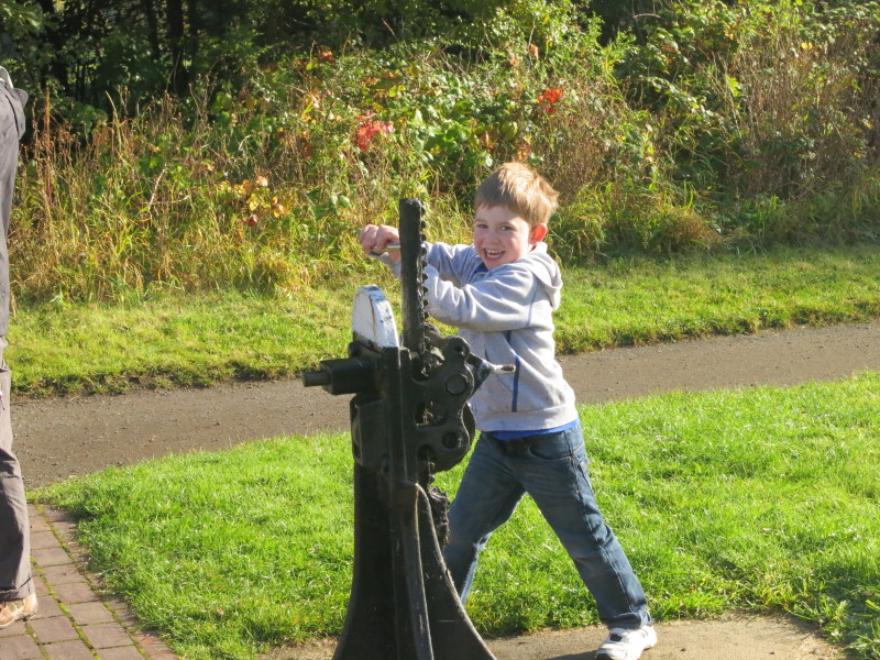
Ben helps with the paddle gear
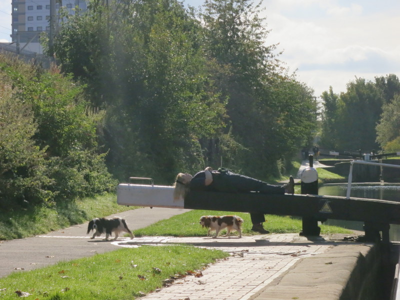
Lucy and the dogs take it easy. It was interesting to note how most of the time
the dogs walked around the balance beams just as a human would, even though
there was plenty of room for them underneath.
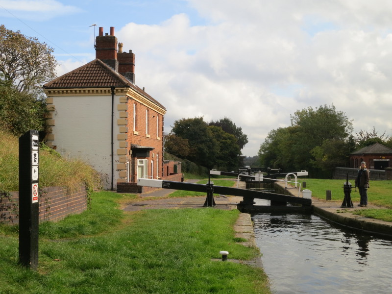
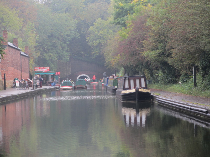
At last we have reached the top lock, with its canalside cottages on the left.
We soon turned left at Horseleyfields Junction onto the Wyrley and Essington
Canal, known colloquially as the Curly Wyrley on account of its sinuous route,
though at this point is it unusually straight. It's also a nice illustration of
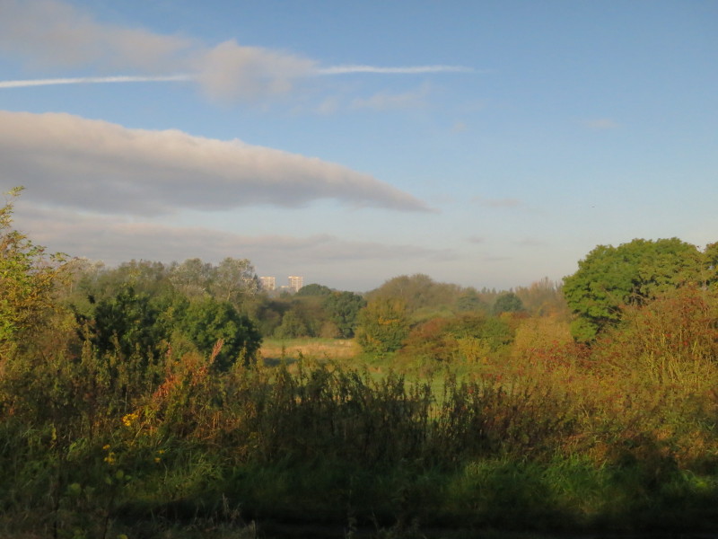
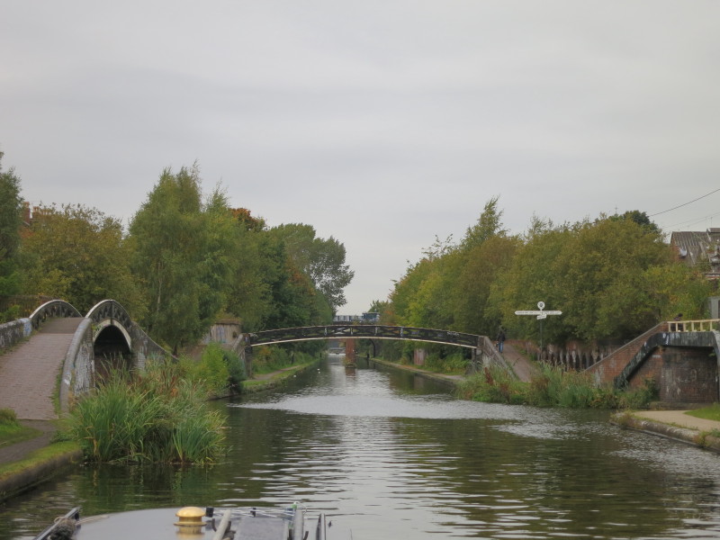
how even though the canal is largely urban, it is still very green.
At Sneyd Junction, the originally planned route of the mainline of the Wyrley
and Essington Canal went straight on, but before the canal was completed, a much
longer "branch" was built leaving on the right here, later coming to be regarded
as the mainline, leaving the original route ahead to be branches to Wyrley Bank
and Essington.
After a lovely day we left the Kenilworth contingent by Birchills Junction and
continued a short way along the Walsall Canal to the top of the locks, this
section being originally opened as the Birchills Branch of the Wyrley and
Essington Canal. The water here was covered in a mat of brown-green vegetation,
which didn't look very attractive, particularly with cans and bottles sitting on
top of it. Still, we had a quiet and secure mooring for the night with a locked
gate the other side of that brick wall.
Monday

Next morning, Ellie mistook the brown-green vegetation for solid land and got
rather wet, but shook off all the vegetation so was left no different from
having fallen into clean water. We returned to Birchills Junction and turned
right to continue along the Wyrley and Essington Canal.
A holiday on the Birmingham Canal Navigations conjures up a very urban image to
most, and indeed a fair bit of our holiday was urban, but a good proportion was
properly rural as here, albeit with urban influences of the graffiti. The canal
guide intriguingly pointed out that this morning we have moved from suburban
housing to open country, but 150 years ago the same journey would have been
moving from open farmland (now with houses) to collieries and industry (now
returned to nature and agriculture).
At Pelsall Junction we turned left onto the Cannock Extension Canal, one of the
last narrow canals opened, being built in 1863 to serve collieries, with the
northern section beyond the A5 closing in 1963. What's left is 2.9 km of
completely straight canal, which means that you can see several bridges through
one another. The bridges are of a very solid construction, their later
construction meaning that they look more like railway bridges than typical canal
bridges.
More rural Birmingham Canal Navigations scenery after we winded the boat at the
far end of the canal.
Passing Ogley Junction, from where the Wyrley and Essington Canal once continued
down through 30 locks to the Coventry Canal at Huddlesford Junction. One day it
may be restored or rebuilt to reopen as the Lichfield Canal. For now though, we
turn left to visit the Anglesey Branch, originally built in 1800 as a feeder to
carry the main source of water for the canal from Chasewater Reservoir, and
upgraded to be a navigable canal in 1850 to serve new collieries.
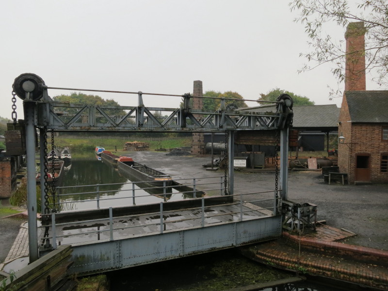
At the far end of the Anglesey Branch is Anglesey Basin, the furthest north it
is possible to travel on the Birmgingham Canal Navigations. This picture is
taken from the wall of the dam of Chasewater Reservoir, still refilling after
being drained for maintenance work. It's a lovely spot but gets very few boats,
especially at this time of year. We have yet to pass another boat moving on this
week's holiday.
We turned round and retraced our route along the Anglesey Branch and part of the
Wyrley and Essington mainline to Catshill Junction where we turned down the Daw
End Branch of the Wyrley and Essington.
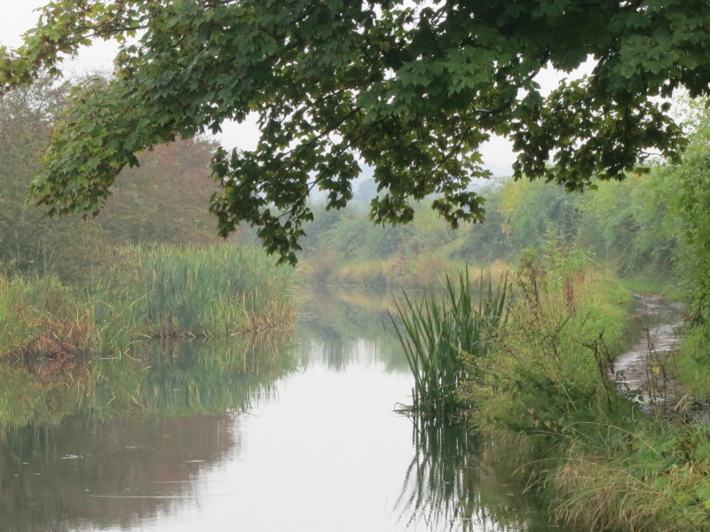
This is another twisting and turning canal, and although it flirts with industry
and suburbia, it retains a largely rural feel to it.
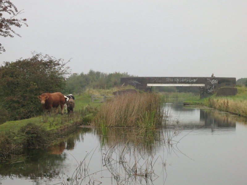
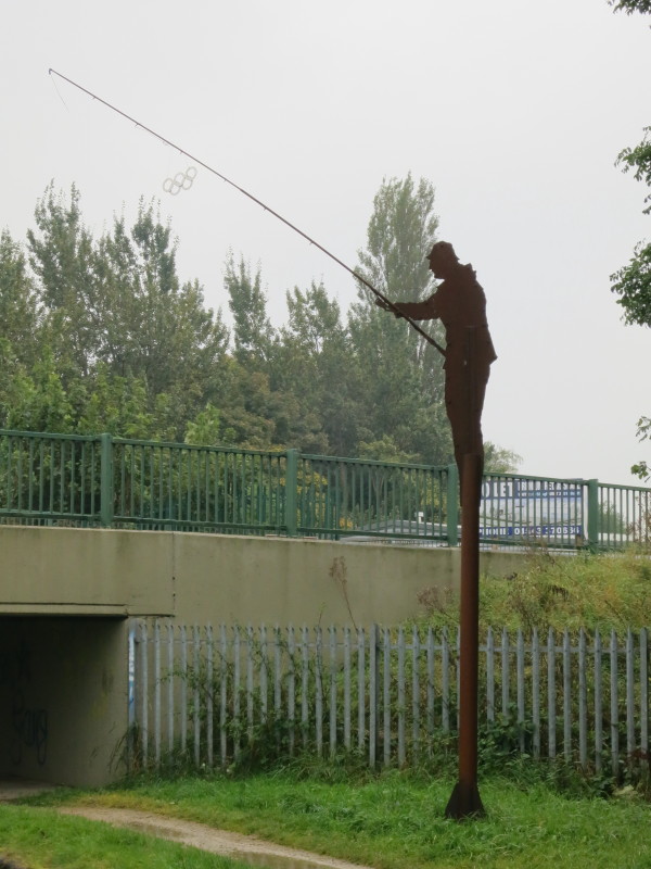
Even the fishermen are friendly on these little-used canals.
We stopped here for the night at Longwood Junction, where the now truncated Daw
End Branch used to run a bit further on the left, now being used solely for
long-term moorings, while the route on the right shows the first of the nine
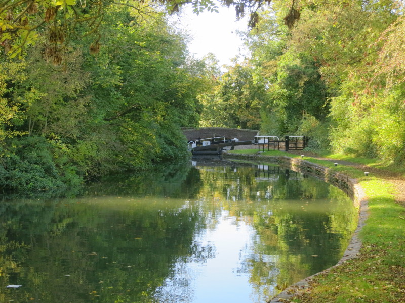
locks of the Rushall Canal.
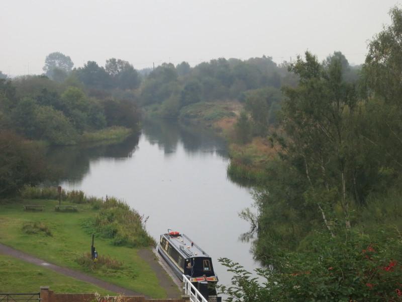
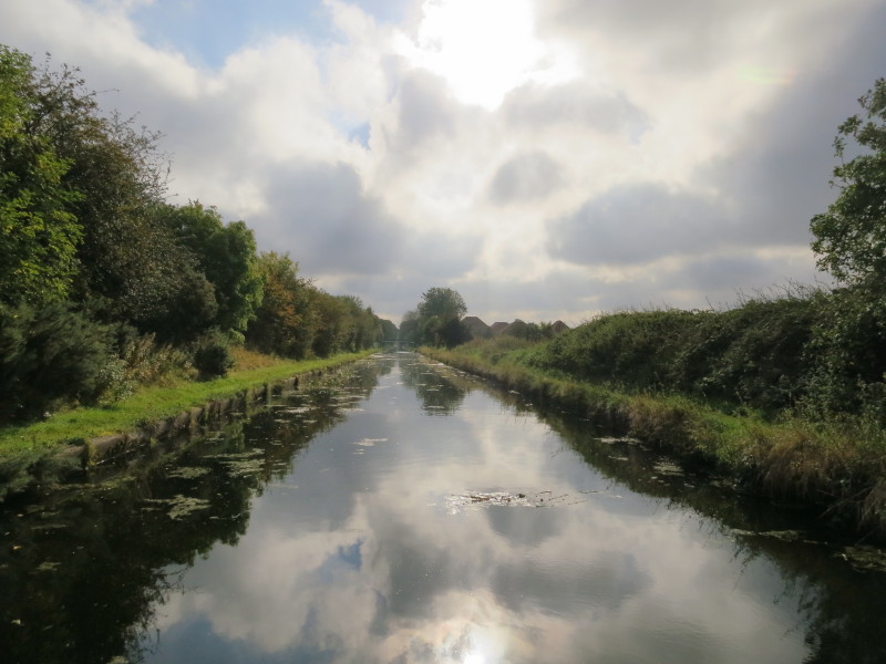
A misty view ahead of the Rushall Canal.
Tuesday
The top lock of the Rushall Canal, built in 1840 by the Birmingham Canal
Navigations as part of the agreement for the government support of their taking
over of the Wyrley and Essington Canal Company. Today the bottom gates of locks
2 and 4 declined to stay open which presented a little difficulty to get the
boat out with only one person working the locks. Lock 5 presented further
difficulties as more water was leaking out of the bottom gates than could be
admitted through the top paddles, and we couldn't get the gate open to let the
boat into the lock: Stephen was forced to empty the lock again, reposition the
bottom gates to produce a better seal, and refill it. That delay allowed a boat
to catch us up coming down behind us at lock 7. Although it didn't pass us, and
so we still haven't passed another moving boat, it was a real encounter with
another boat on these quiet waters.
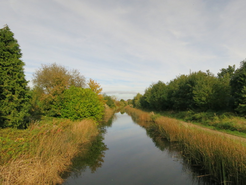
The Rushall Canal is near urban areas, but feels more rural on the ground than
it looks on the map. In the distance, tower blocks hint at the urban world not
far away.
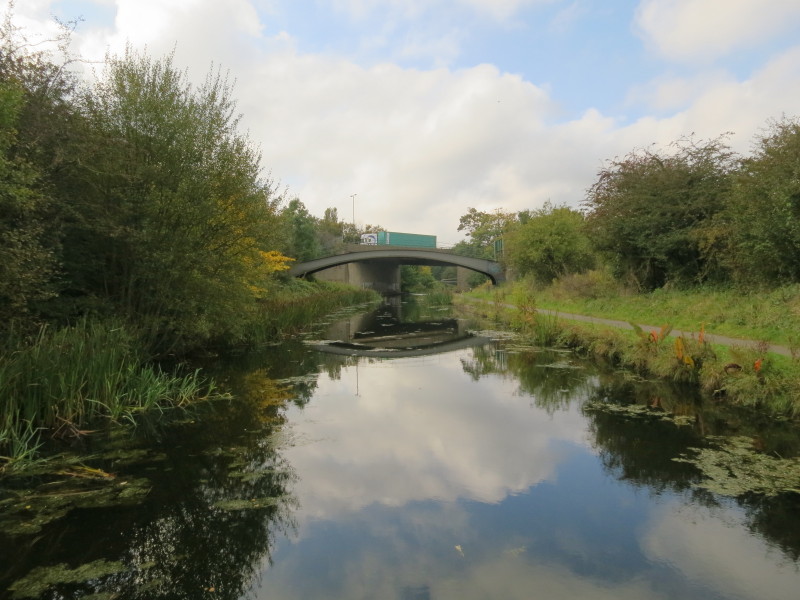
A more intrusive hint is the M6 motorway, but even the approach to that is very
green and quiet. Just under the M6 bridge we reach the Tame Valley Canal where
we turn left and go under the M5
The straight Tame Valley Canal marches across the landscape on high embankments
and deep cuttings, a sure sign of its later construction - it was built in 1840
as a by-pass, an alterative route to avoid boats having to go through central
Birmingham including the overcrowded Farmers Bridge locks.
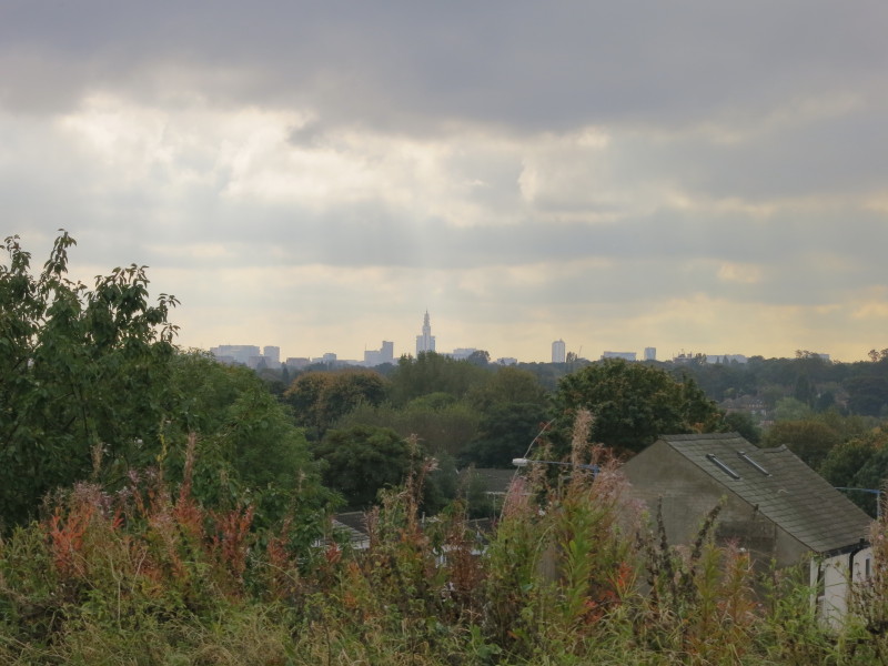
From one of the embankments, a view to central Birmingham with the Post Office
tower always a good direction indicator
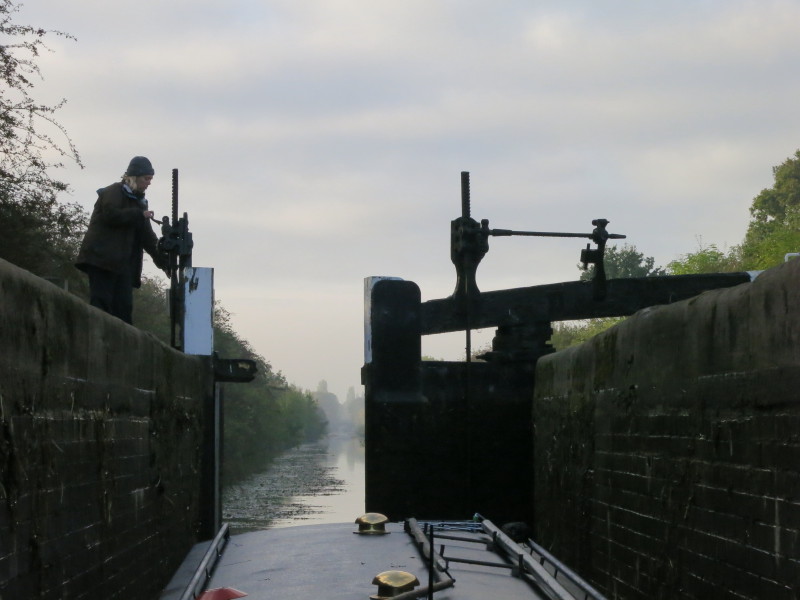
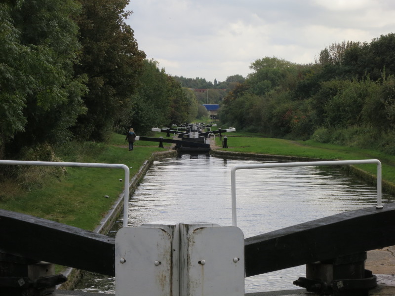
Lucy fills the top lock of the 13 Perry Barr locks
Stephen steers carefully into a lock
This portion of the Perry Barr flight provides a welcome glimpse of a different
world when passing on the M6 where the blue lorry is below. While this lock is
emptying, Lucy has gone on ahead to fill the next lock before returning to this
lock to open the gates and let Stephen and the boat out. Once the boat is out,
she has to close these gates again, then rush on to the lower lock again to open
the top gate for the boat.
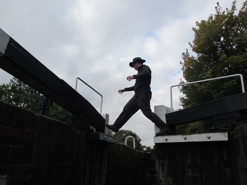
Stephen steps boldly from one lock gate to another. The alternative is walking
the full length of the lock four times (there and back when opening the gates,
and there and back when closing them). We moored below lock 7 for lunch, with
all 7 having been set against us.
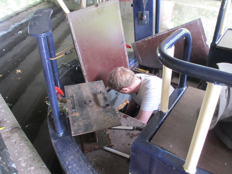
Soon after setting off again, the boat stopped responding properly, and it was
time to take up the weed hatch and remove the detritus that had accumulated
around the propeller. Despite the stories of the northern reaches of the
BCN being full of rubbish, this was the first time we'd needed to access the
weed hatch this week.
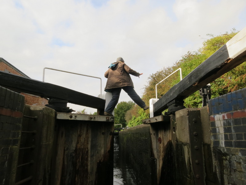
Underway again, and Lucy demonstrates the lock gate hopping.
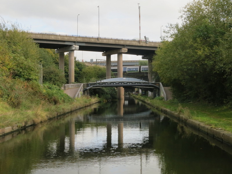
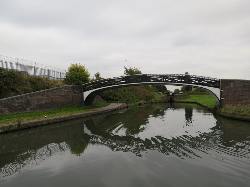
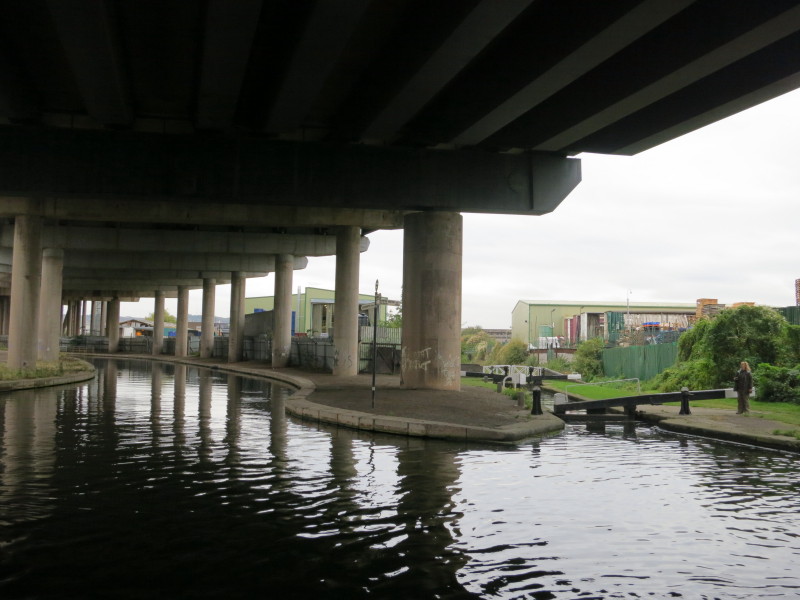
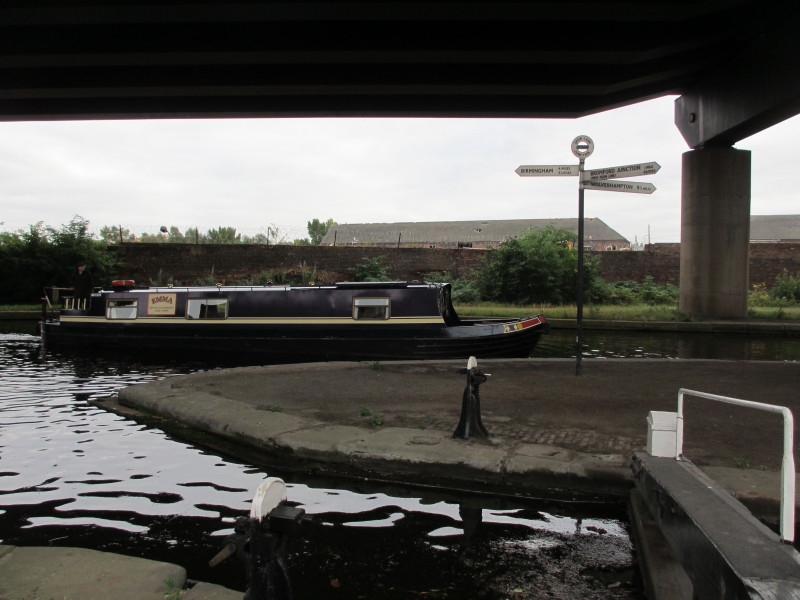
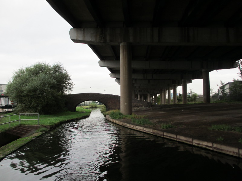
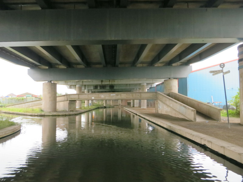
Safely through the Perry Barr 13, we head for Salford Junction, hidden and
almost forgotten beneath the concrete jungle of Gravelly Hill Interchange,
better known as Spaghetti Junction. Its 559 concrete columns allow the junction
to serve 18 routes, also fitting in the River Tame, the Cross City railway (see
the train in the picture), high voltage cables (note the curved "bridge"), and
of course Salford Junction where the Tame Valley Canal, Birmingham and Fazeley
Canal and the Saltley Cut of the Grand Union Canal all meet, all engineered to
allow the horse-drawn boats free passage underneath as there were still some
around when the junction was built.
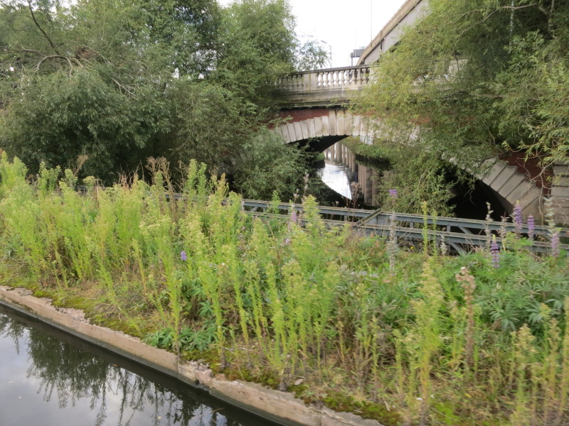
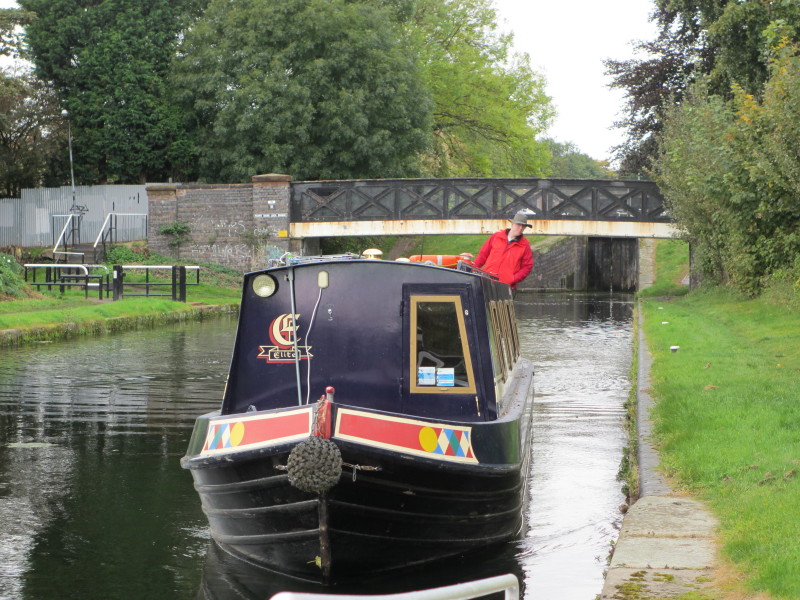
Having turned right onto the Birmingham and Fazeley Canal, we immediately cross
an aqueduct over the River Tame, seen here reflecting some of the pillars of the
M6 in the water under the A5127 Lichfield Road.
We continued through Aston Locks 11 to 9, and moored for the night at the
business park at Rocky Lane, a surprisingly quiet spot and with the added
reassurance of a security guard patrolling the business park regularly.
Wednesday
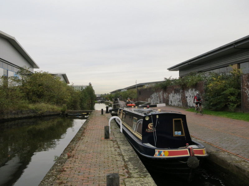
Next morning we continued up the Aston flight of locks, the towpath here being a
fairly busy cycle route
At Aston Junction here, we turned right to continue along the Birmingham and
Fazeley Canal, passing under the Aston Expressway
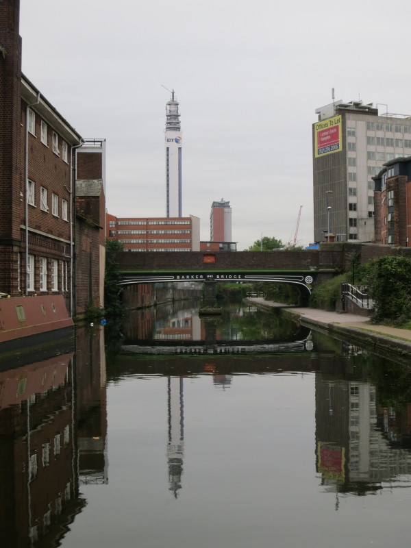
Approaching the attractive Barker Bridge with the Post Office Tower in the
distance, before starting our ascent of the 13 locks of the Farmers Bridge
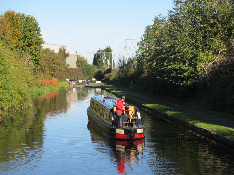
flight. Between locks 12 and 11 we passed Swallowtail, the first moving
boat we've passed this week, which had the added advantage that the locks were
now empty as we approached them.
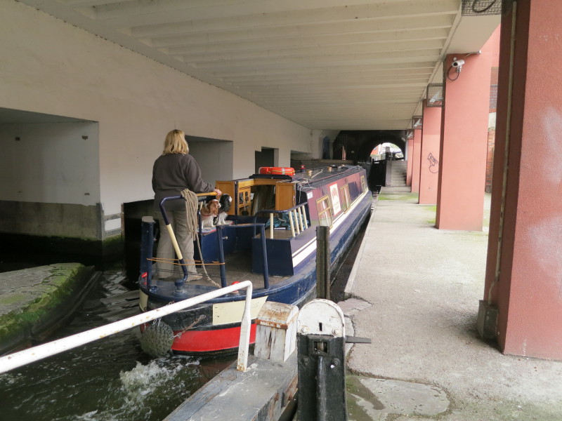
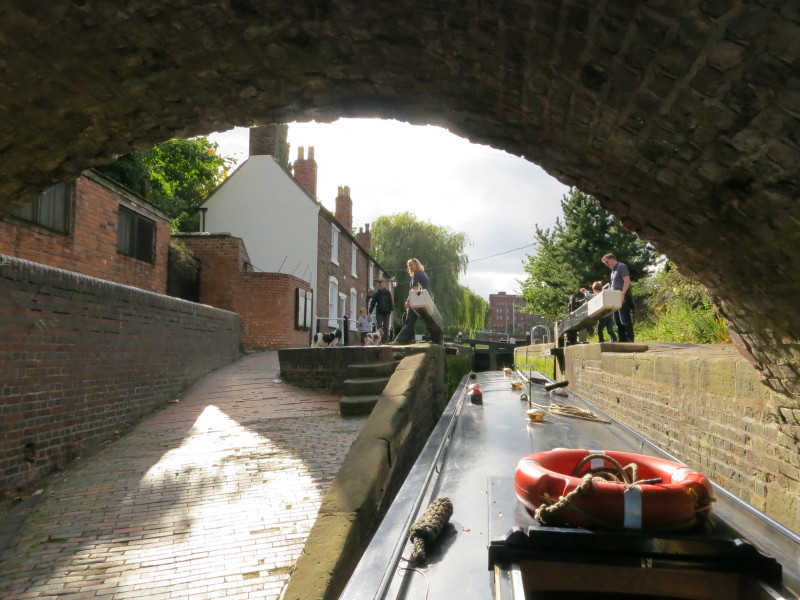
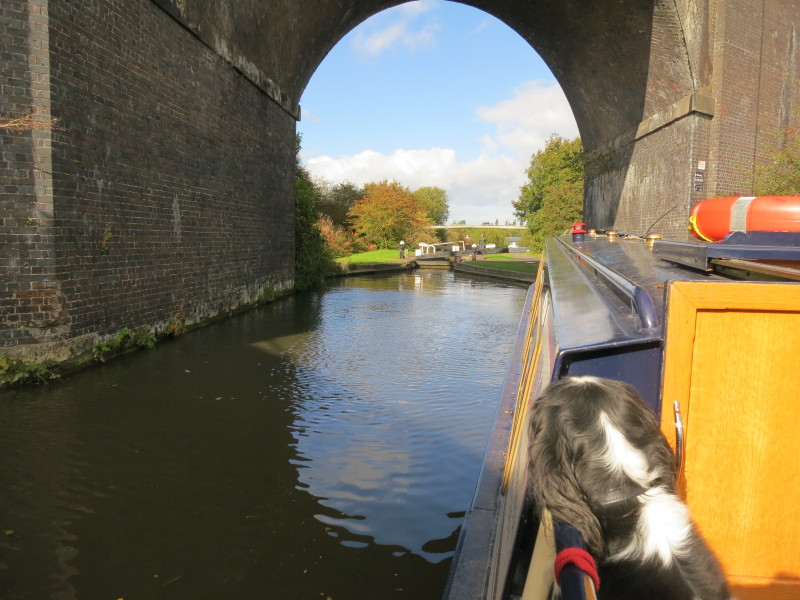
The semi-subterranean section of the Farmers Bridge flight.
The lock-keeper, Toby, had passed us going down the flight doing a litter pick,
and when he came back past, he opened the bottom gates of each of the locks for
us, making our passage easy and swift.
As we approached Old Turn Junction through the bridge on the left of picture
there was an unusual sign: "Boaters slow down! Please report to Police on
arrival at barrier. Security measures in operation." Fortunately the blue
barrier seen here was on the route to Gas Street Basin and so didn't affect us.
Later investigations revealed that it was part of security measures for the
Conservative Party conference being held at the ICC, and that boats were only
being allowed through with police escort on board.

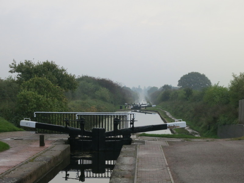
As our progress up this morning's 21 locks had been pretty decent, taking us
just 2 hours 40 minutes from unmooring to Old Turn Junction, we did a little
exploring, coming along the Main Line on the left of picture and executing a
sharp turn (probably not possible in a longer boat) into the Oozells Street
Loop, originally James Brindley's route of the Birmingham Canal until Thomas
Telford's improvements produced the new route on the left of picture. Neither of
them would recognise what has become of the place with all the modern
developments and the water devoted to leisure. We did a circuit of the Loop and
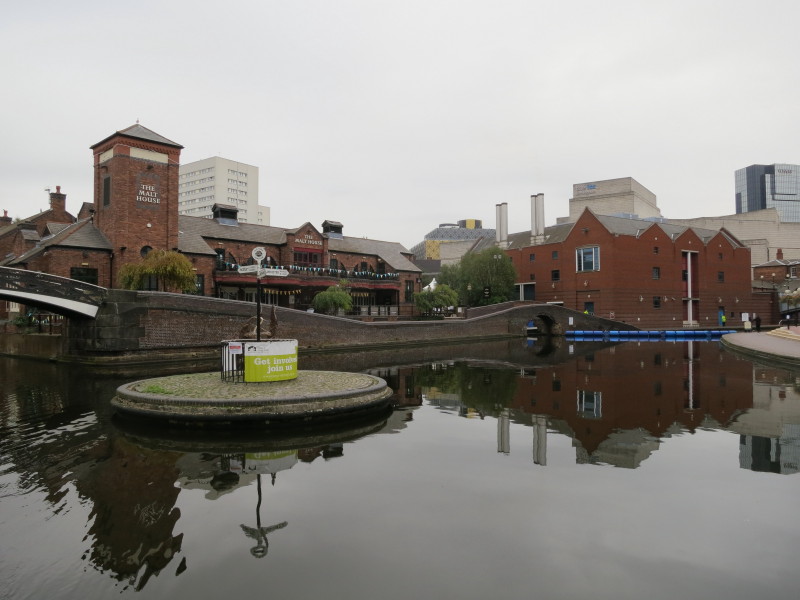
moored close to Old Turn Junction to do a little shopping and have some lunch at
the Handmade Burger Company, somewhere Lucy had wanted to go last time we were
on the canals in Birmingham in 2009.
The afternoon saw us take Telford's New Main Line as far as Rotton Park Junction
where we turned right onto the Soho Loop of the Old Main Line. We'd visited the
Rotton Park Loop on the left during our previous visit to the area in 2009, but
the Soho Loop was again new territory for us.
The loop proved to be surprisingly pleasant and green, with a large party of
school-children waving enthusiastically to us as their teacher photographed us
going by. As we were a little pushed for time to do what we wanted to do this
afternoon, we went past the short Soho Branch, here, saving that for another
time.
On the New Main Line again, we approach a former toll island and gauging station
At Smethwick Junction, the New Main Line continues to the left while the Old
Main Line diverges right to climb through the three Smethwick Locks
We had gone up the Smethwick Locks in order to visit another bit of canal
we hadn't boated before, the Engine Arm, seen here from the newish winding hole at its end.
Presumably the wooden structure is to facilitate loading or unloading from
boats, but it seems rather elaborate at the top.
The Engine Arm was built in 1825 as a feeder from Rotton Park Reservoir to the
summit level of the Old Main Line above the Smethwick Locks and to carry water
pumped up from the canal below the locks. The feeder was made navigable five
years later to facilitate bringing coal to the steam pumping engine: beyond this
wall the narrow feeder continues from the reservoir.
From the lower New Main Line, a view of the Engine Arm Aqueduct with Lucy and
Emma heading back towards Smethwick Locks.
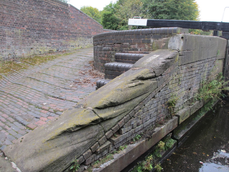
We went back down the locks with their evidence of the abrasion caused by two
centuries of towropes, back to the New Main Line where we turned right.
Now on the New Main Line, we pass under the Engine Arm Aqueduct which we'd
passed over a little earlier.
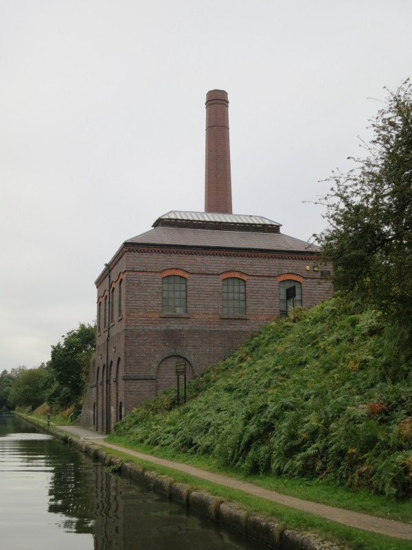
The new pumping station at Brasshouse Lane replaced that on the Engine Arm, and
pumped water up from the Birmingham Level where we are to the Wolverhampton
level out of sight above to the right.
We passed through the modern Galton Tunnel, built to allow the construction of a
dual carriageway above, and then under the impressive Galton Bridge. Constructed
in 1829 by Thomas Telford, at the time it was the highest bridge in the world.
It is also an illustration of the depth of the cutting that Telford forced for
his new line for the canal, deep below the natural level, and all dug by hand.
Continuing along the cutting we head for Spon Lane Bridge
The canal is hemmed in by old factory buildings on the right and the retaining
wall of the Wolverhampton railway line on the left. Immediately ahead of us is
Steward Aqueduct which carries the Old Main Line above the New Main Line. The
railway on the left then runs over the top of the upper canal, and the M5
strides high above all three lower transport routes.
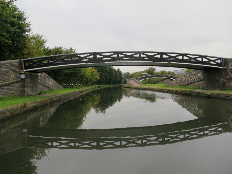
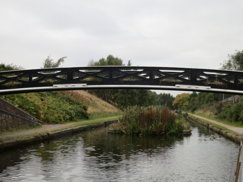
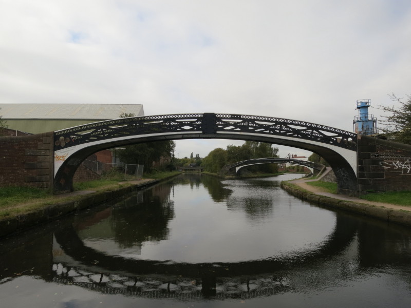
The New Main Line was built with a towpath on each side, which means that every
junction requires at least two towpath bridges, usually these simple but
elegantly beautiful bridges made by the Horseley Ironworks Company in Tipton.
Here we approach Bromford Junction where we have a sharp turn to the right to
take the Spon Lane Locks.
The Spon Lane Locks are infrequently used nowadays but were part of the original
route of the Wednesbury branch of the Birmingham Canal and heavily used taking
coal into Birmingham. Most of the New Main Line from here to Pudding Green
Junction is actually the route of the Wednesbury branch of the original canal.
Two herons watched closely as we made our turn towards the locks - one can be
seen on the rise underneath the bridge on the left, the other has taken to the
skies and can be seen above the bridge.
At the top of the three Spon Lane locks, we join the Old Main Line, now under
the M5 motorway. Lucy watches from the lock while Stephen turns the boat through
almost 180 degrees to pick her up near the signpost.
Lucy's view as Stephen heads for Wolverhampton.
We're very fortunate that the canal still had some commercial carrying on it
when the M5 and M6 motorways were built, otherwise the canals would probably
have been obliterated, as many other canals in the area have been by road
projects, even as recently as the 1990s. But it does seem odd to see this bridge
(Blakeley Hall Bridge) retained, going from nowhere to nowhere, its name
recalling a long vanished and forgotten residence.
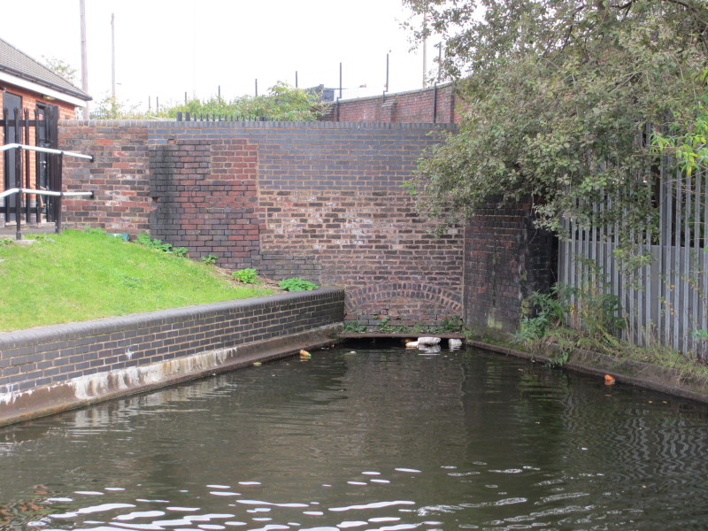
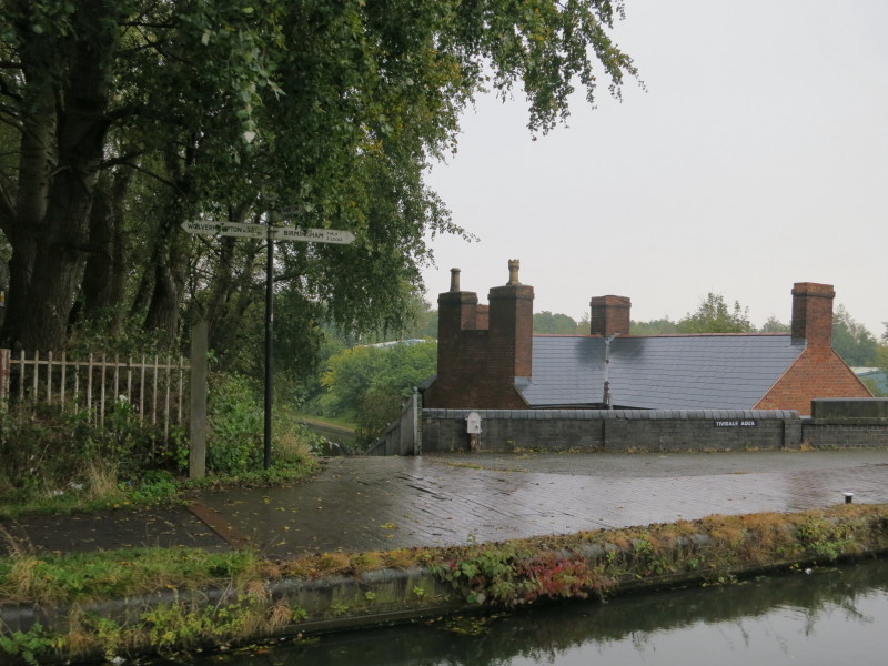
A little further, we reach Oldbury Junction where we turn left onto the Titford
Canal.
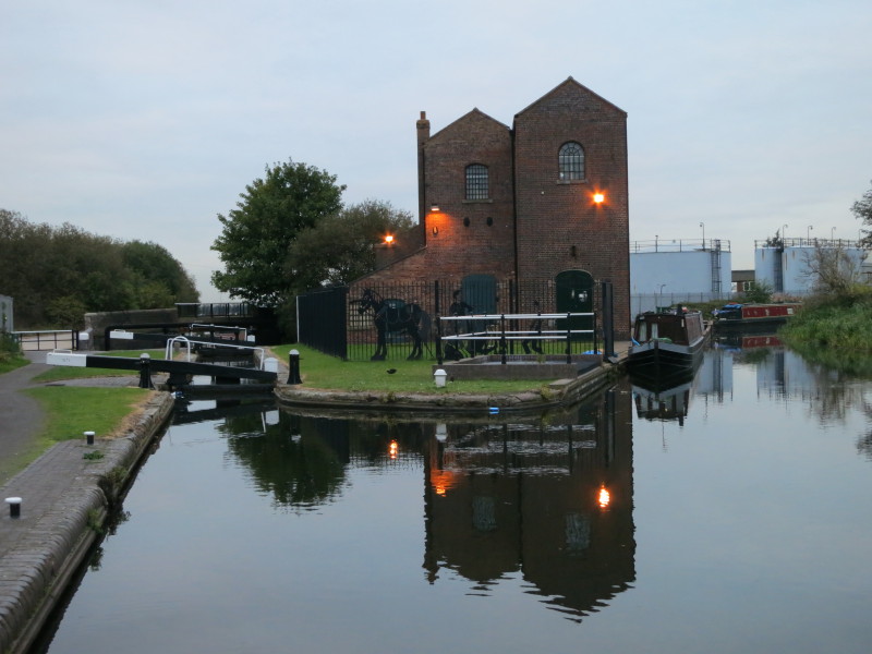
With the light starting to fail by the end, we climbed the six locks of the
Titford Canal to reach the pumping station here. This is now the highest point
on the Birmingham Canal Navigations. On the right is the start of the Spon Lane
Branch, also known as the Tat Bank Branch, which is another feeder from Rotton
Park Reservoir which was made partially navigable. We initially tied up on the
left above the lock, but were invited by the owner of the first boat on the
right to reverse into the canal and moor alongside the Birmingham Canal
Navigations Society's working boats. It meant a more awkward journey onto and
off the boat for the dogs, but did mean that we were again safely behind a
locked gate and free from any anxiety about what the local populace might get up
to.
Thursday
Thursday was forecast to be wet and so we planned a short day of cruising. Sure
enough it was raining when we set off to visit the rest of the Titford Canal.
Beyond Jarvis Bridge the canal and its Portway and Causeway Green Branches were
officially abandoned in 1960. The area where the routes diverge is known as
Titford Pools, and can still be visited by what the Pearson's Canal Companion
describes as "intrepid" boaters, the main risk being running aground. Their lack
of maintenance, lack of boats and the effect of almost fifty years of grit and
gravel running off the M5 have all taken their toll. So Lucy winded the boat
while Stephen made a brief exploration on foot along the Portway Branch and
under the M5.
Quite attractive under sunny skies, no doubt, if one ignores the HV cables and
pylons, and the traffic on the M5 thundering just behind.
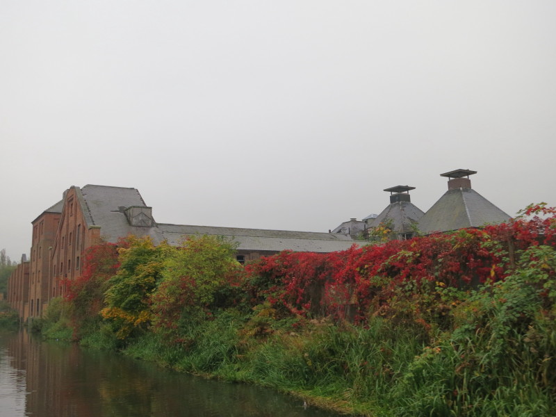
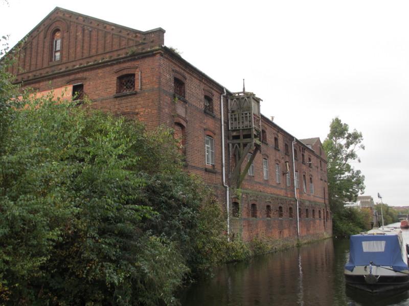
Returning along the Titford Canal we pass grand derelict warehouses damaged by
fire
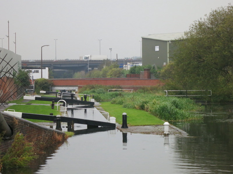
Descending the locks towards the M5, we find that the overflow weir from this
pound isn't doing its job properly and there is too much water with the edges of
the lock underwater. It has been raining for a while and there is water coming
down the flight, but it's not a huge volume and the overflow weir should be able
to cope better. Despite water pouring over the top gate as Lucy emptied the
lock, the bottom gate opened without too much difficulty.
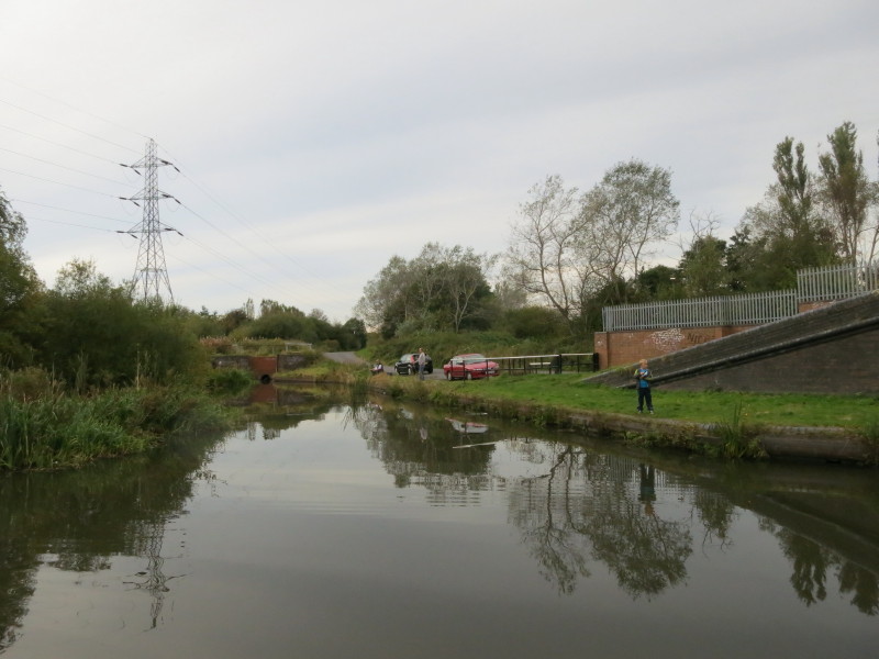
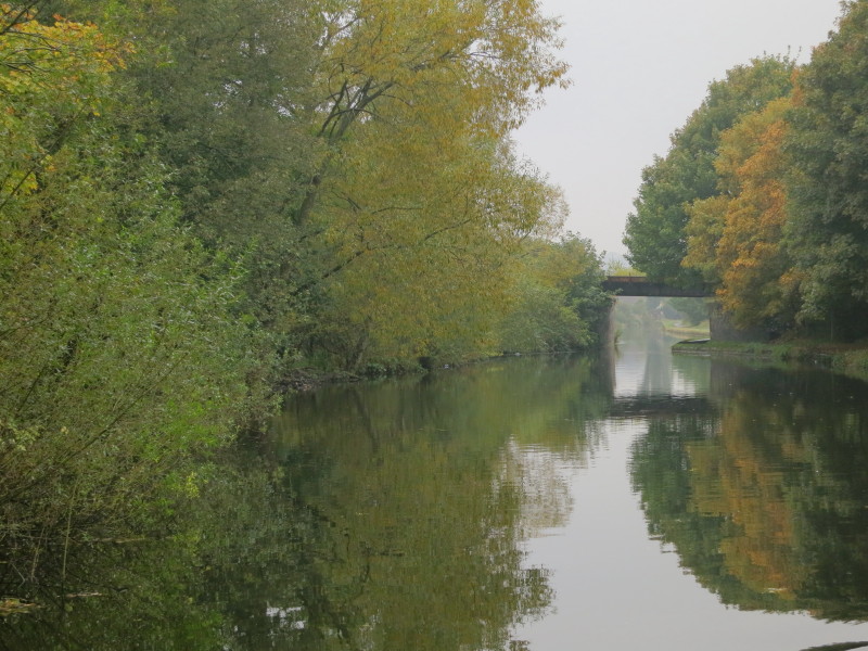
After a stop at Oldbury for a bit of shopping and a prolonged lunch bread, we
continue heading along the Old Main Line towards Wolverhampton, passing over the
Netherton Tunnel branch
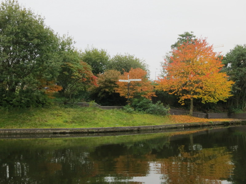
A dreary day but the developing autumn colours help to add a little cheer
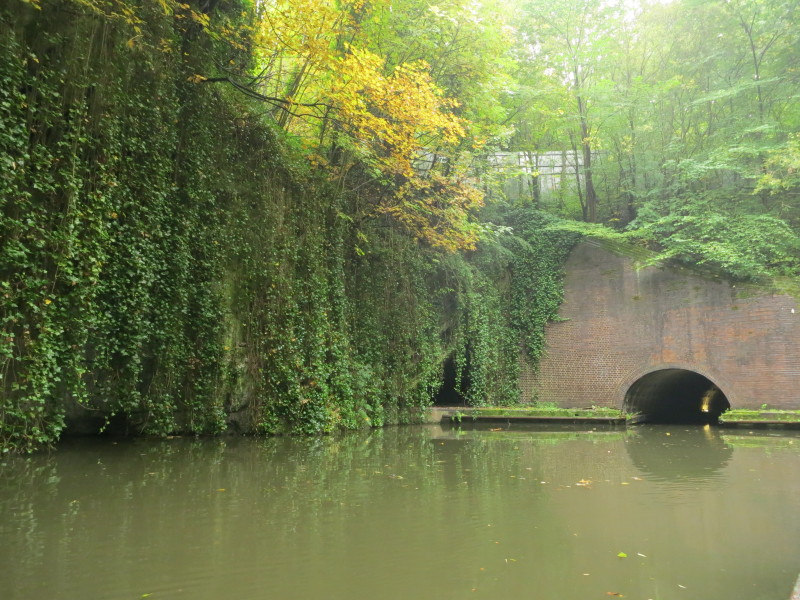
We turned left at Tipton Green Junction towards Dudley Tunnel. The tunnel has a
very restricted loading gauge due to subsidence and is much too low for our
boat, quite apart from diesel engines being prohibited.
The Black Country Living Museum has always been somewhere on the "to do" list,
but on a miserable afternoon it was destined to stay there for a bit longer.
Instead we took a trip on one of the Dudley Canal Trust's trip boats. The canal
passes through the 196-yard Tipton Tunnel into Shirts Mill Basin, and then an
even shorter tunnel into Castle Mill Basin. From here the original Lord Ward's
Canal heads west into the hillside and its limestone mines, the Dudley Tunnel
proper heads southwest on its 2942-yeard subterranean journey towards Parkhead
Junction, while we take a 1989 tunnel into the mines.
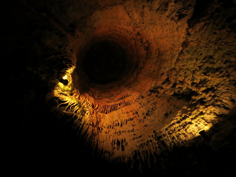
The 45-minute tour was interesting, showing and describing a little of the
history from the laying down of the limestone and coal starting 420 million
years ago to the history of the mines and the tunnels. The route took in the
Singing Cavern where there is a long tradition of underground concerts, and
nowadays you can even get married there. We returned by a different tunnel
linking into the Dudley Tunnel.
A display in the remains of a side-tunnel, now closed off due to subsidence
Friday

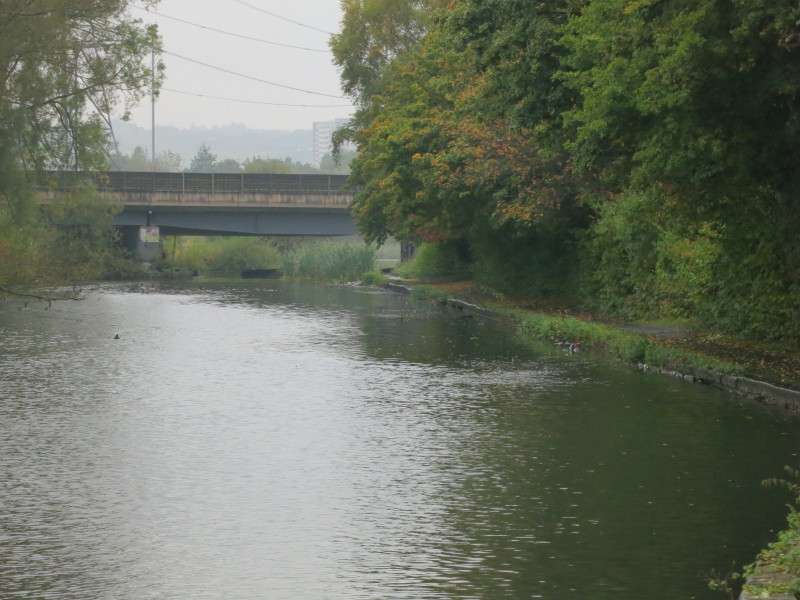
Continuing our route along the Old Main Line back towards Wolverhampton
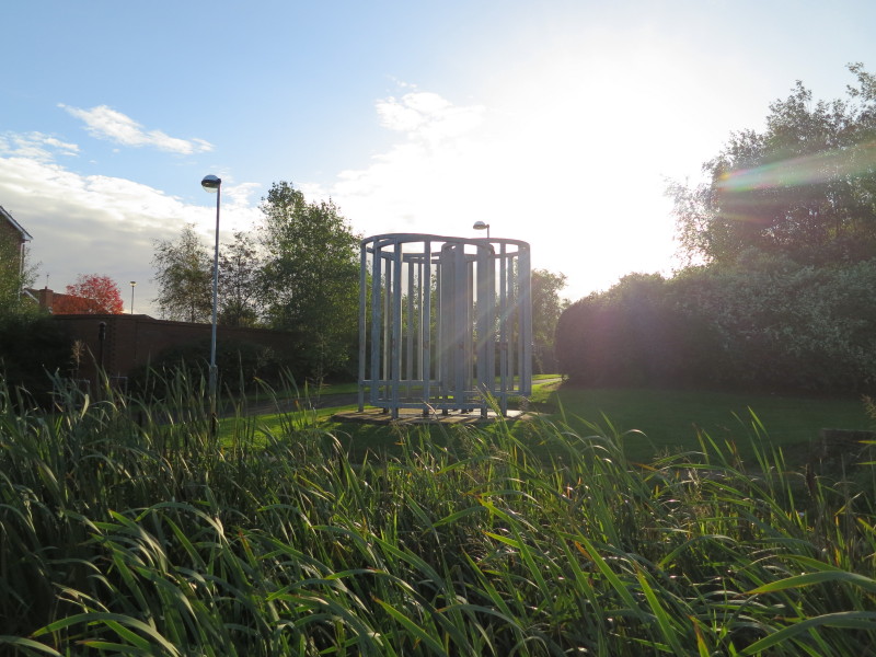
Passing the site of a steel works, now covered in modern housing but
commemorated with this steel sculpture.
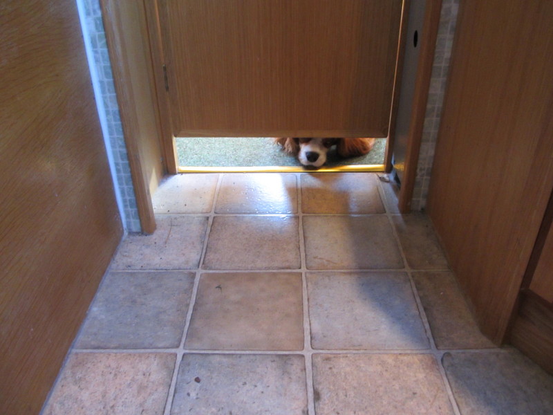
Hetty looking mournfully under the door between the bathroom and saloon.
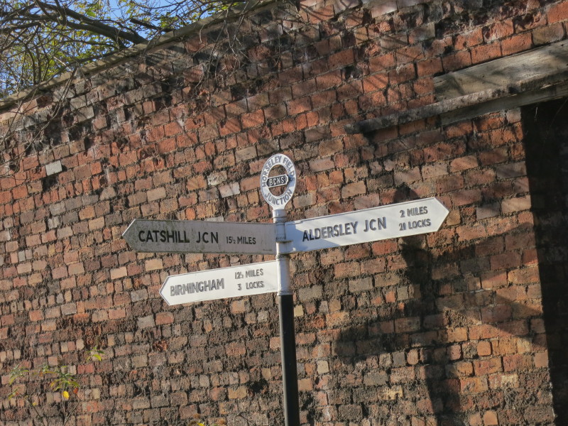
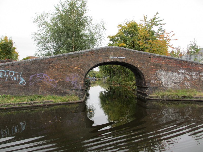
Passing Horseleyfields Junction where the Wyrley and Essington Canal leaves,
meaning that we have completed our loop and are retracing our route from
Saturday and Sunday.
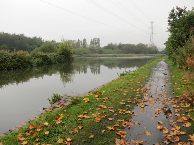
Just a bit more of the level canal through Wolverhampton before we reach the
locks.
Stephen at the tiller as we descend the 21 locks of the Wolverhampton flight
Hidden in the undergrowth near one of the locks is this pit, the remains of a
railway turntable.
Ellie looks on as Lucy prepares the lock for the boat
Almost there - Lucy steers the boat through the pound between locks 20 and 21
Lock 21 and the junction bridge
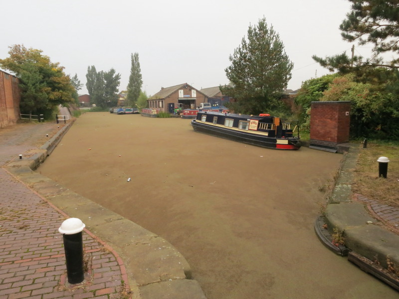
From next to the stop-lock at Autherley Junction, the boatyard awaits the return
of our boat.
Zoom in for more detail, or click to view larger map in new window
A lovely week's holiday, exploring new canals for us, mixing
rural and urban, old and new, decaying and restored. Not perhaps everyone's cup
of tea, but very enjoyable, and nice to be just the two human beings most of the
time after all our canal holidays in bigger groups.
|