Thames Path - Kingston to Kew Bridge, including
Capital Ring - Richmond to Brentford
19 May 2007
It didn't seem long since the last Thames Path walk, but it was three months
(though we did walk a bit of it on our Grand
Union Canal walk in April), so
on a pleasant May day it was time to explore a bit more of the great waterway,
and pick up a "free" bit of the Capital Ring too, during a walk from Kingston
Bridge to Kew Bridge.
After the walk from Kingston railway station, we reach the Thames at Kingston
Bridge, which carries the
London Loop over the Thames - it was thus the third time we'd done the walk
between the bridge and the railway station. (Since today's walk, we've walked
the Thames Path to here from Chertsey, and
so this is the fourth time we've intersected with this bridge on a walk in only
13 months).
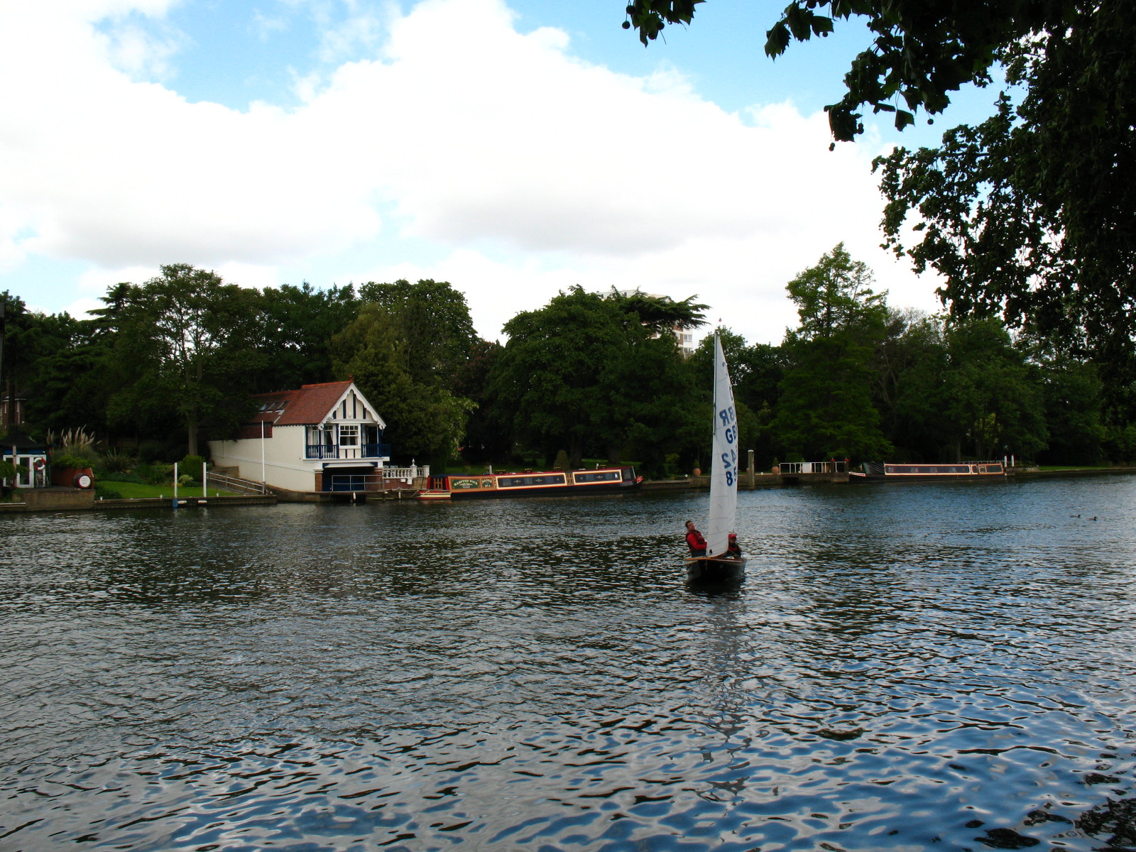
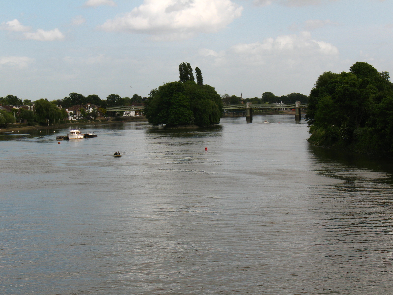
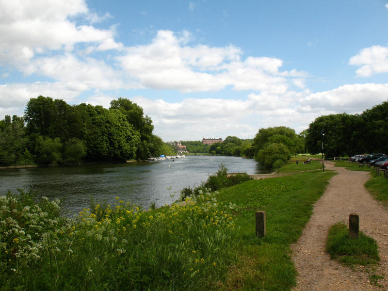
As we follow the east bank northwards, there were lots of sailing dinghies out
enjoying the breeze.
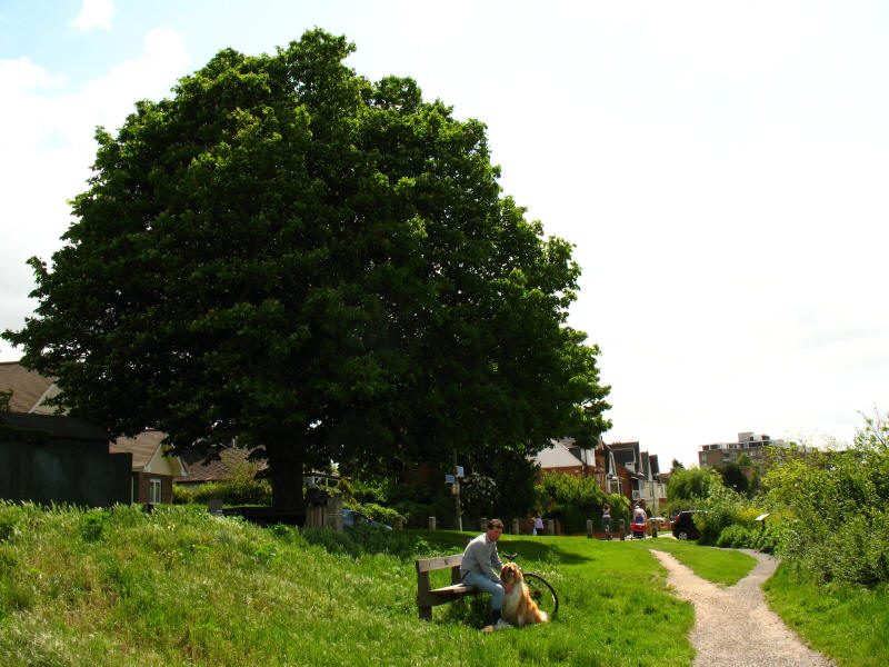
An elm tree known as "Half Mile Tree" was a local landmark on this spot for
centuries. Its name indicates the approximate distance to Kingston. In its later
years it was hollow inside, and it is said that a man could stand upright within
its trunk. Later the trunk was filled with concrete in an attempt to preserve
it. The elm was probably more than 500 years old when it was finally felled as
unsafe in 1951, to be replaced a year later by this horse chestnut.

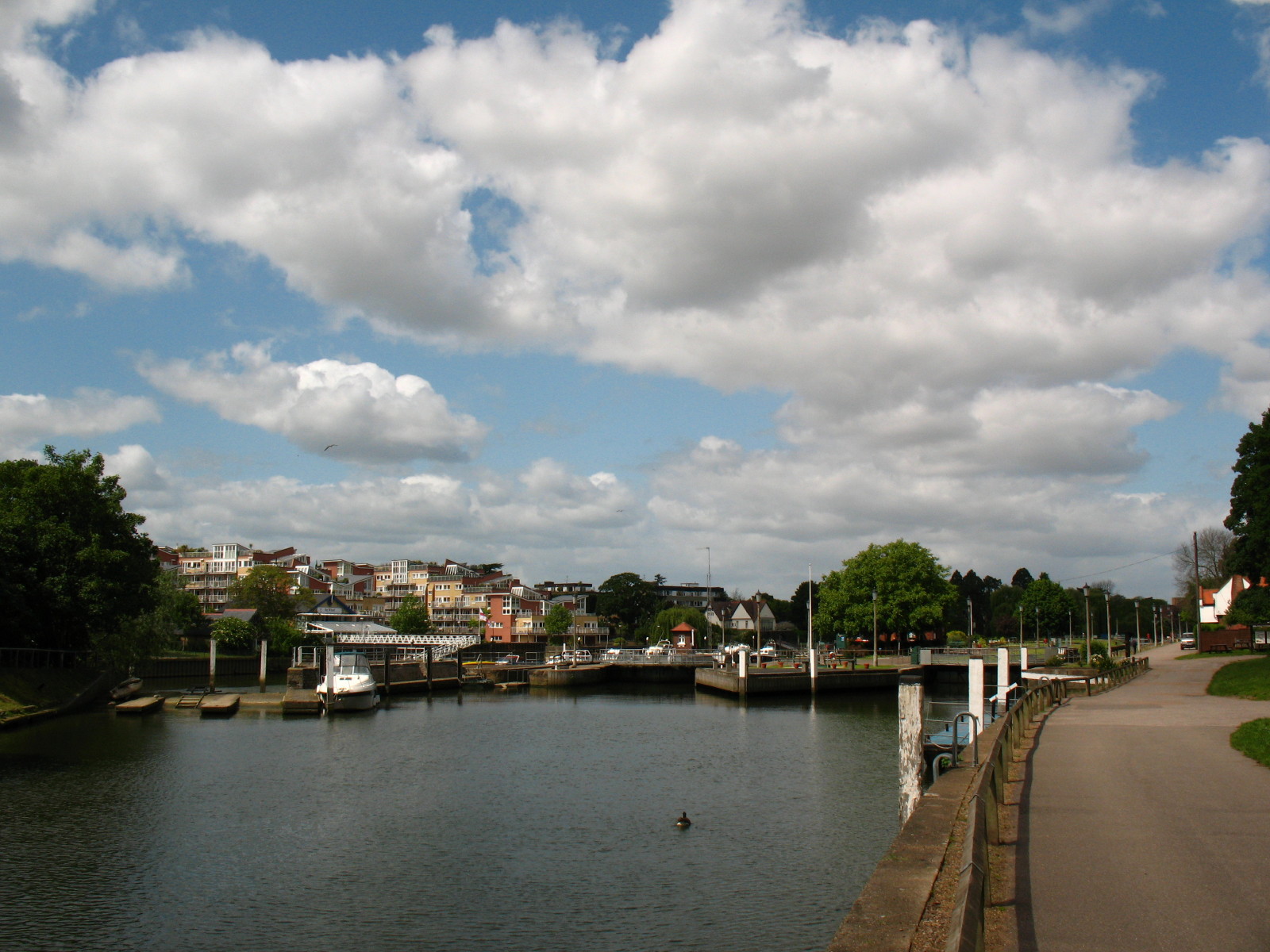
We then reached Teddington Lock - or, more accurately, Locks, since there is a
choice.
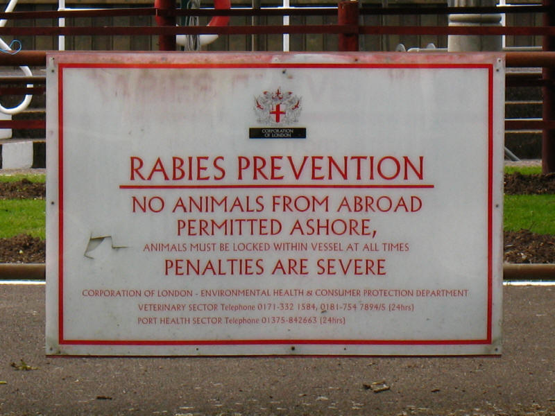
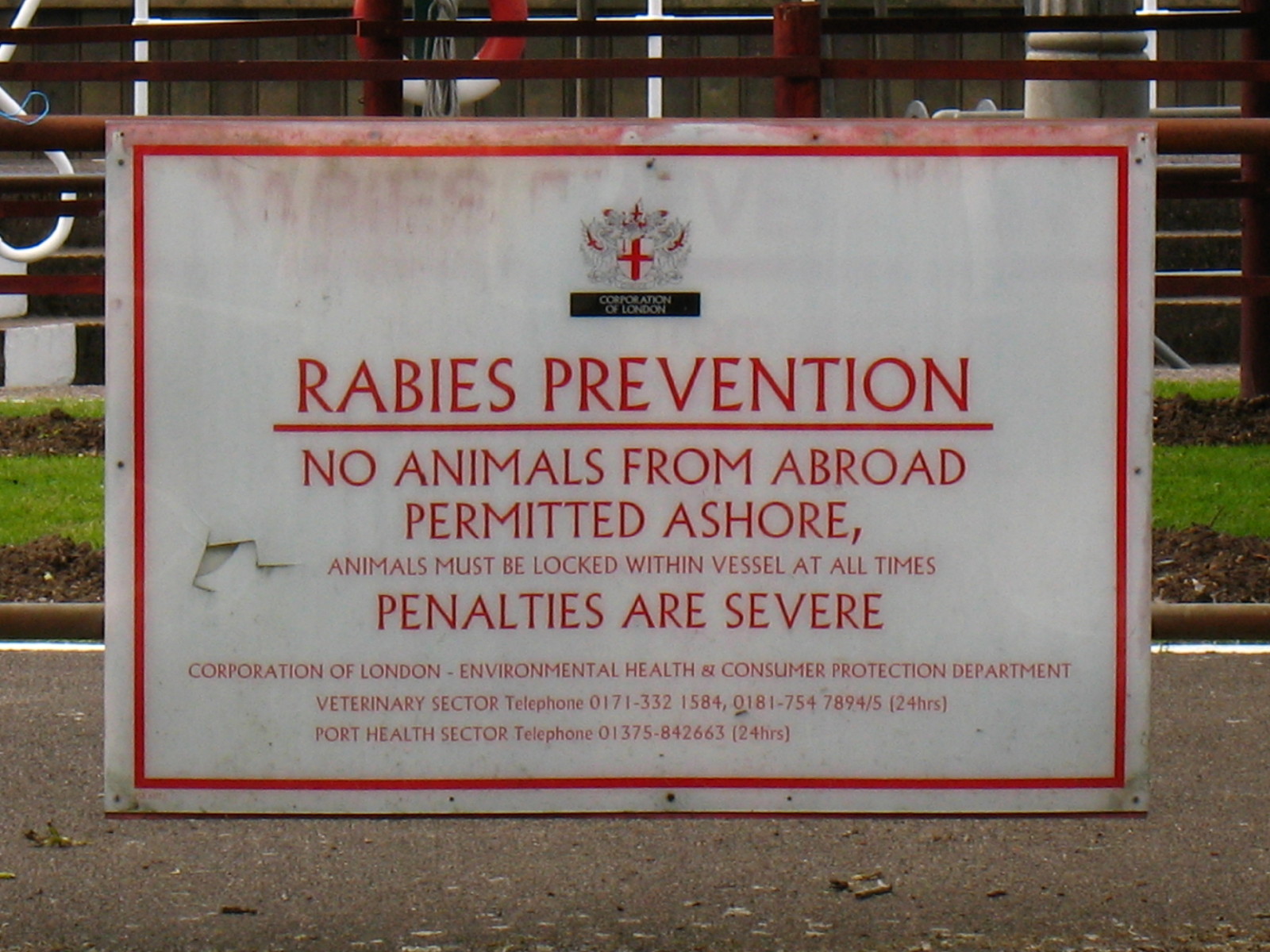
It is odd to see this notice so far from the sea, but when Richmond lock isn't
in use, Teddington Lock is the first on the river and so might conceivably be
the first footfall for overseas vessels.
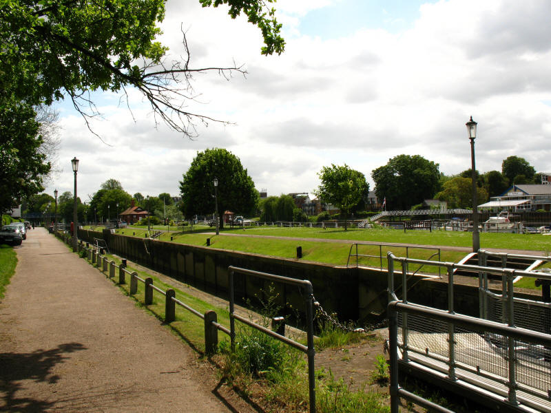
The big lock at Teddington is noticeable for its great length - appearing to be
quite disproportionate to its width. From here the Thames Path splits in two,
following both banks; for the moment, we stick with the east bank.
We make our way past Ham Lands nature reserve, seeded quite literally when the
old gravel pits were filled with rubble from bomb sites across London. Ahead we
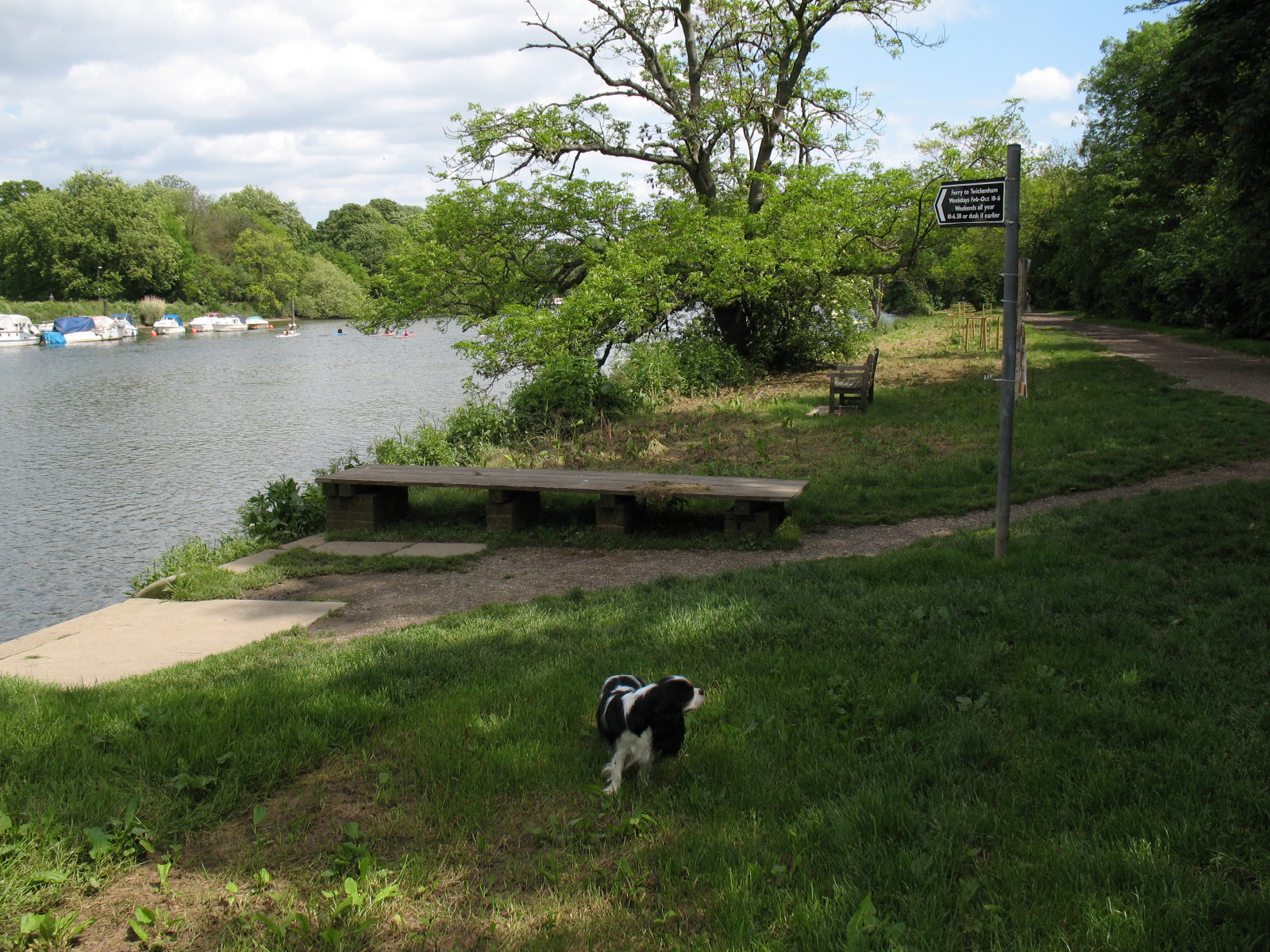
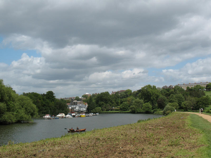
get our first glimpse of the Star & Garter Home

Ellie, perhaps waiting for the ferry to Twickenham, but our way continues along
the east bank.
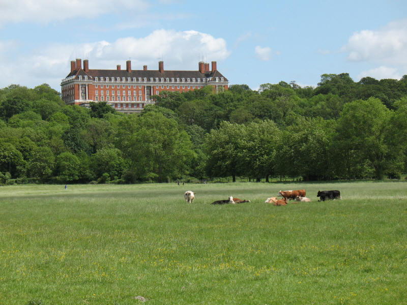
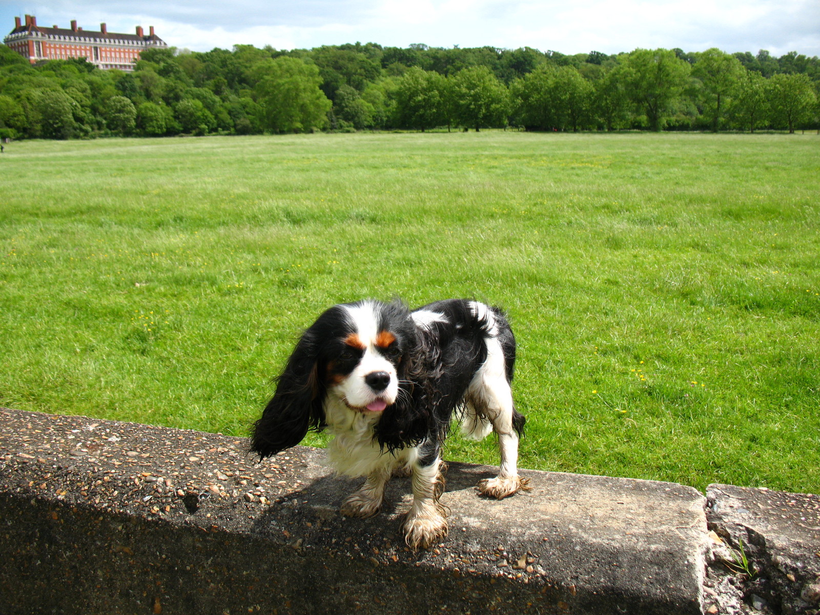
A little further on, we look across the cattle-grazed Petersham Meadows, still
deliberately flooded from time to time. The Star & Garter Home looks down.

Ellie on the concrete flood wall in front of Petersham Meadows.
Walking alongside Petersham Meadows, the houses of
Richmond start to come into
view. As the path reaches the end of the meadow on this corner, we are joined by
the Capital Ring path, which has
come through Richmond Park.

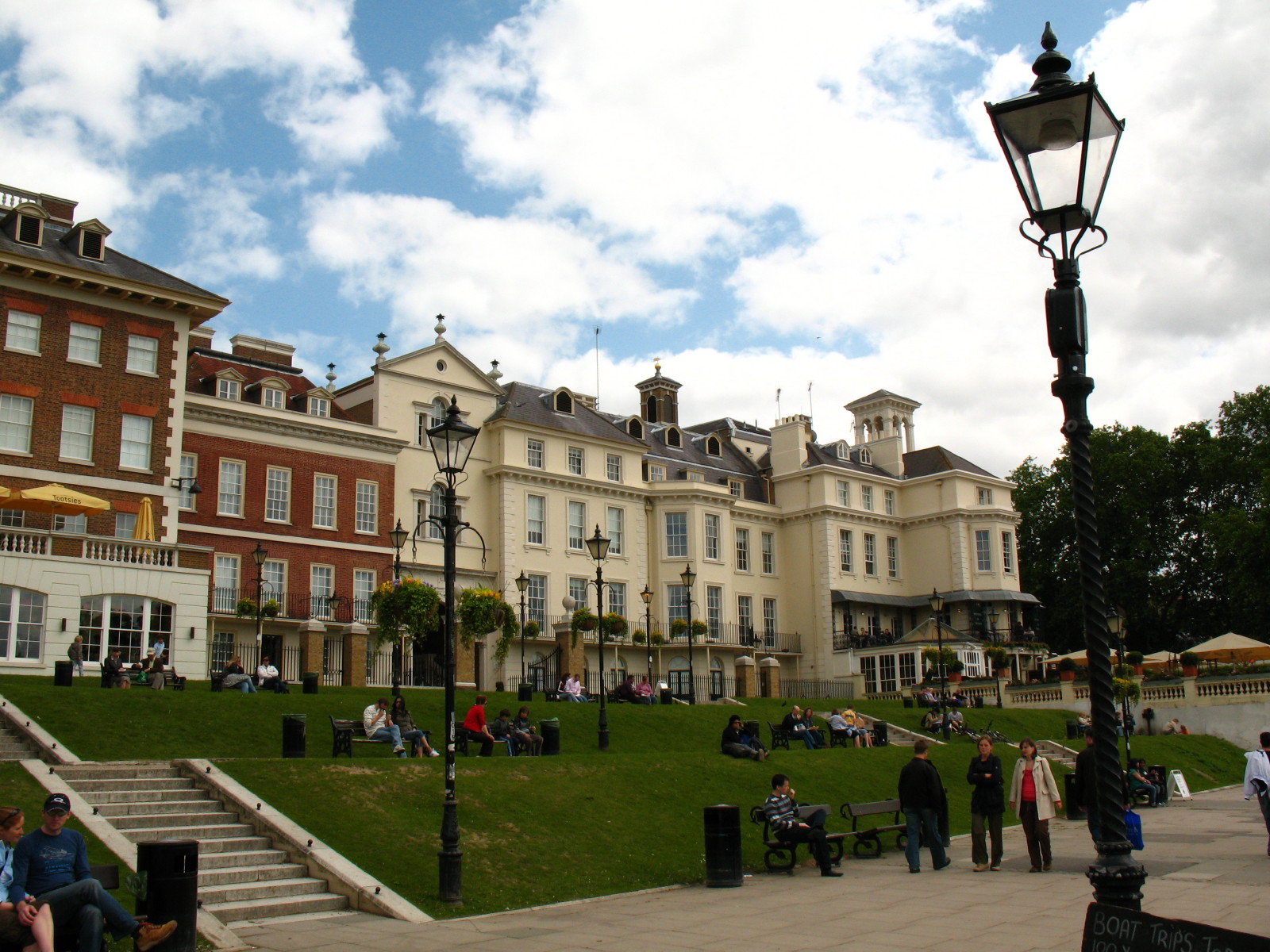
The riverfront at Kingston is a popular place to congregate and sit about
watching the world go by. There are also lots of places to eat.
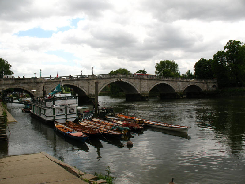
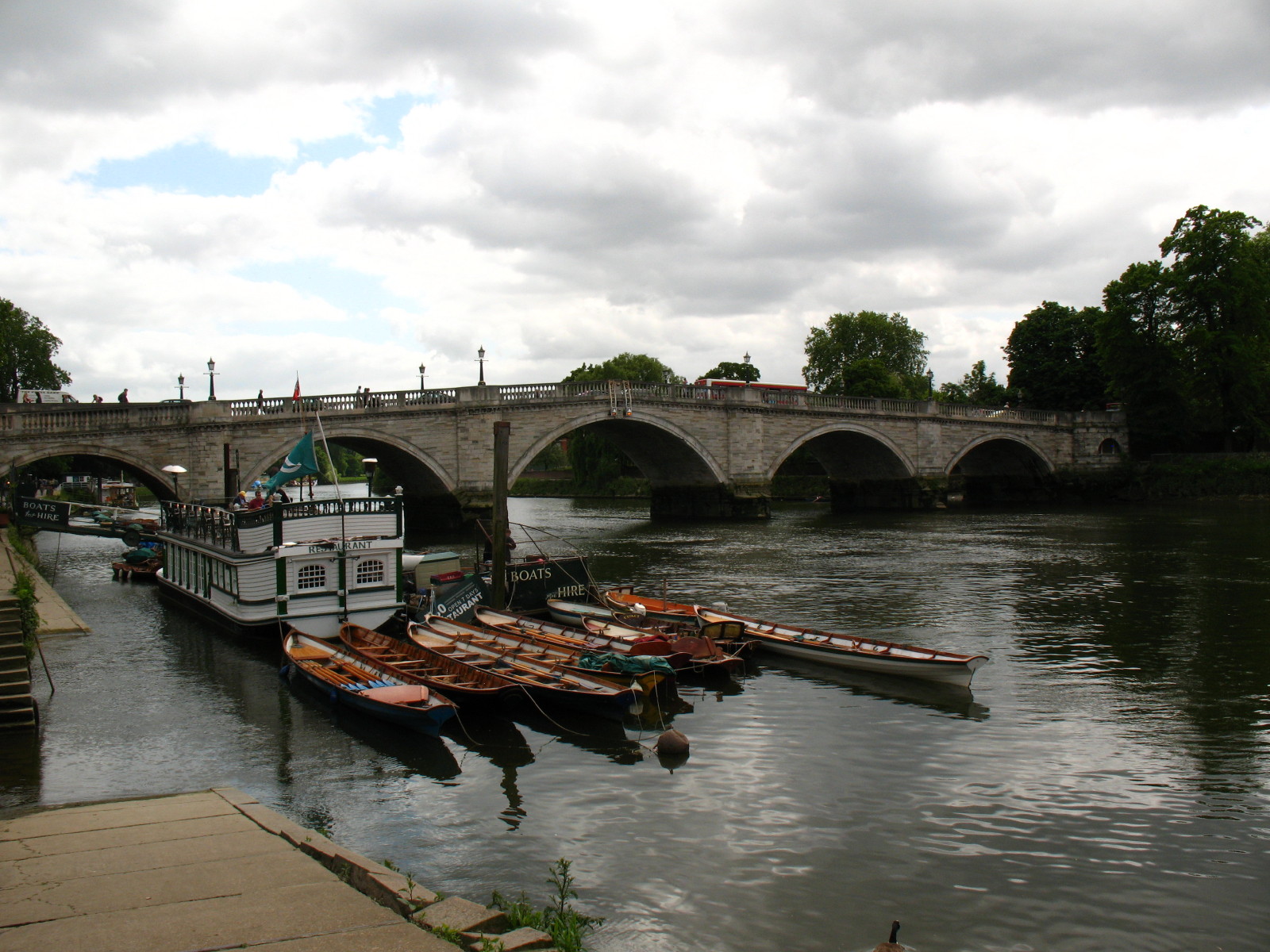
Boats for hire just below Kingston Bridge.
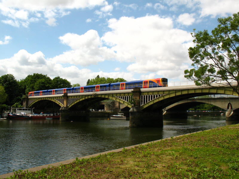
A train for Waterloo crosses Richmond railway bridge
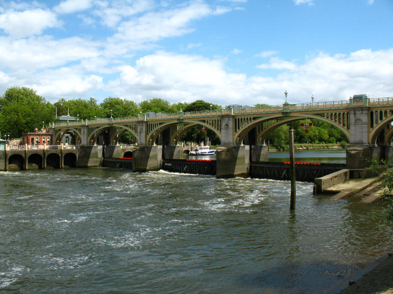
We then reach Kingston Lock. This is a semi-tidal lock, where weirs maintain the
water levels upstream, but are overtopped at high tide, so boats use a
conventional lock at lower states of the tide, but can pass through the arches
of this bridge at high tide.
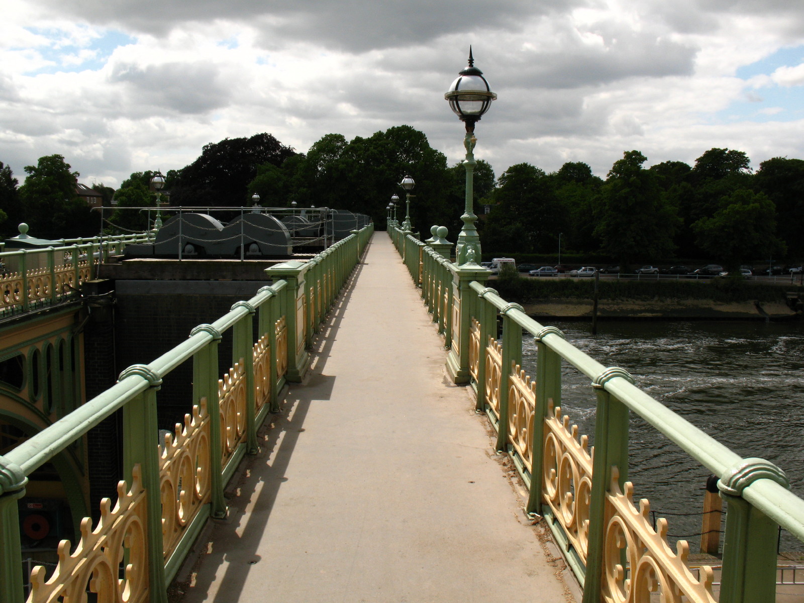
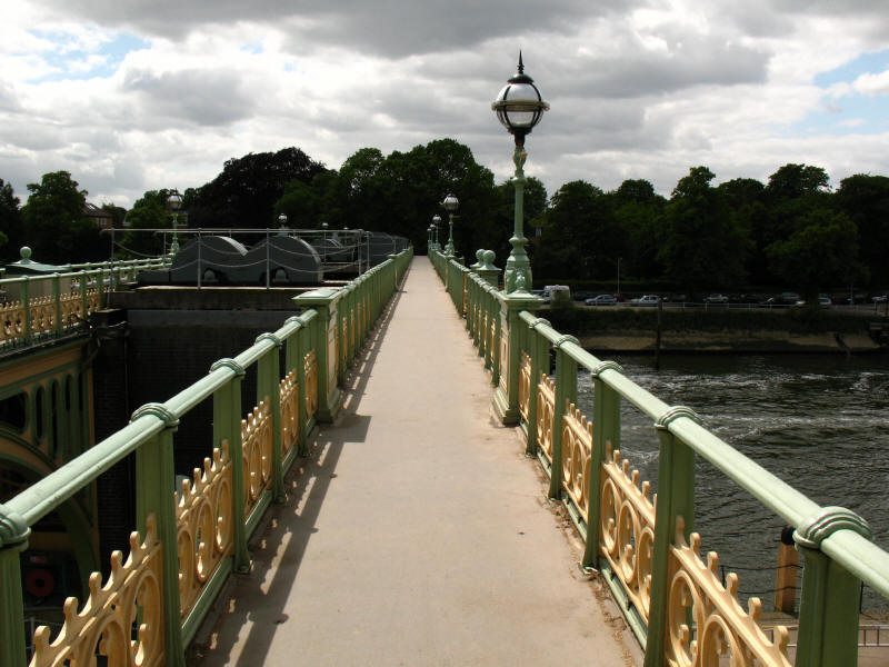
We have crossed the Richmond Lock bridge, continuing to follow the Capital Ring,
and joining the western bank route of the Thames Path
As we leave the banks of the Thames for a short diversion through Isleworth, we
cross the River Crane, after travelling 13.5km from its source in Hayes, it is
now only a few metres short of its outflow into the Thames.

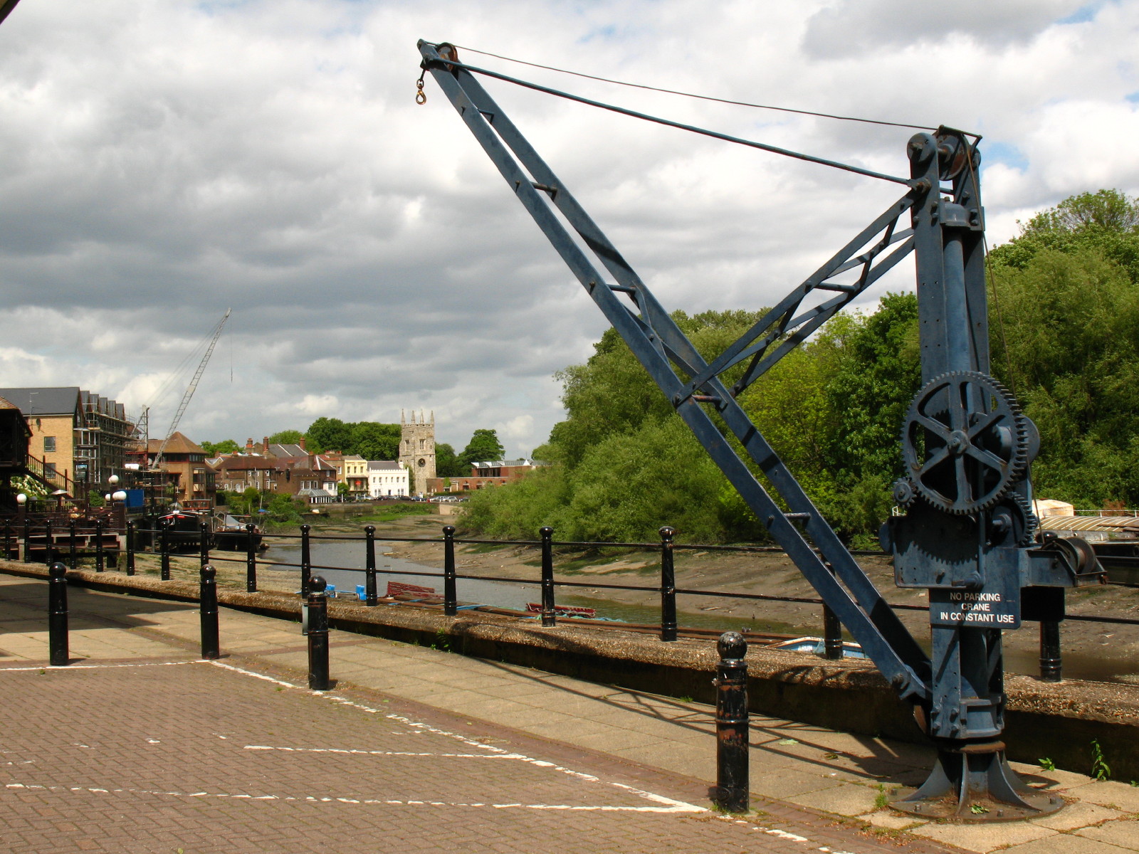
Briefly reaching the Thames again, an interesting variation on a commonly seen
sign instructs us that there is to be no parking here as the crane is in constant
use. In the distance is the tower of Isleworth church, the tower now being
attached to a modern building as the remainder of the church was destroyed in an
arson attack during the Second World War.

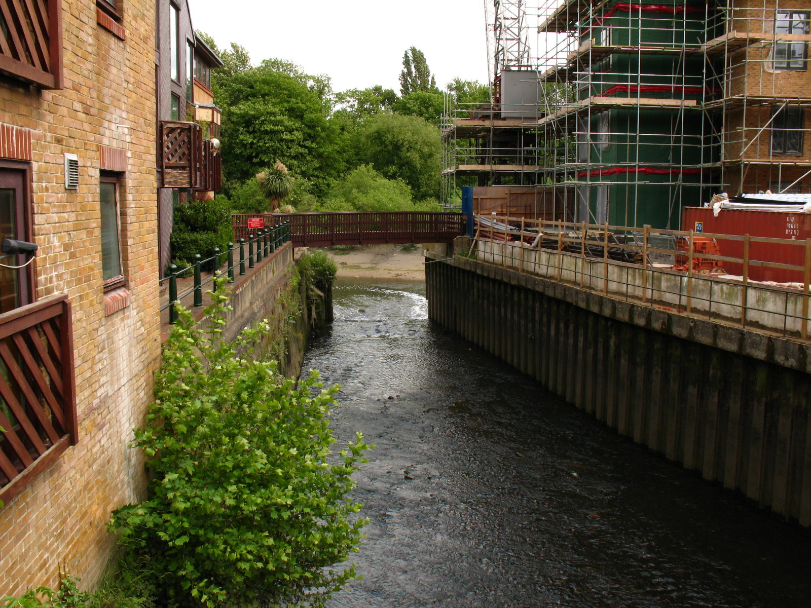
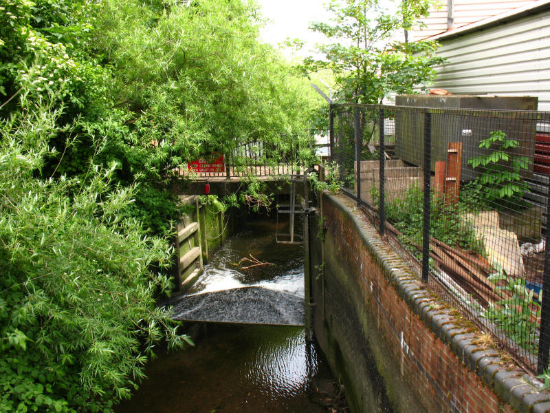
From Mill Bridge, looking down the Duke of Northumberland's River to the Thames.
The Duke's River was made in the 16th century to provide water for Isleworth
flour mill, and diverts water from the River Colne at Longford into the River
Crane, and a second artificial section brings it here to Isleworth and the
Thames. Part of the water also is diverted north to supply ornamental ponds in
the grounds of Syon Park.
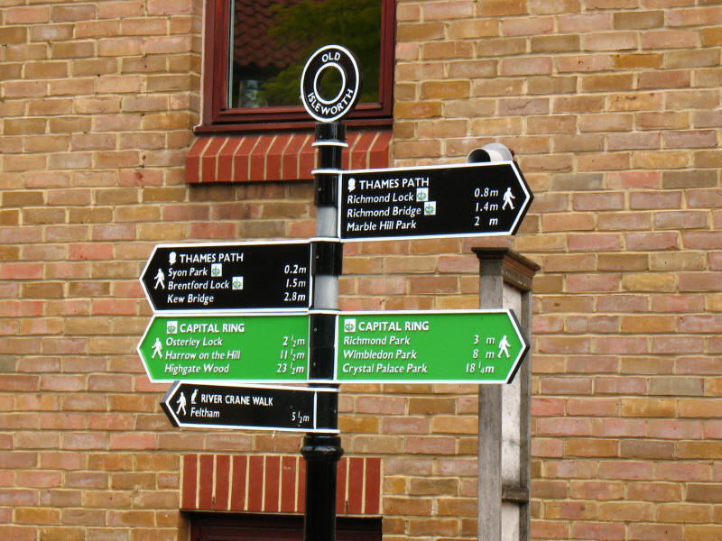
Passing through Old Isleworth, a sign confirms that we are still following the
Thames Path and the Capital Ring, and that we are now leaving the River Crane
Walk.
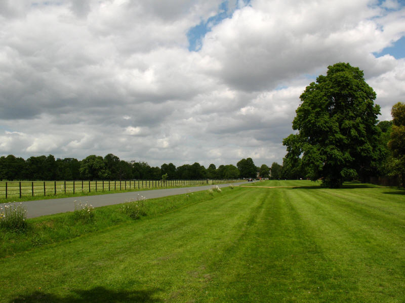
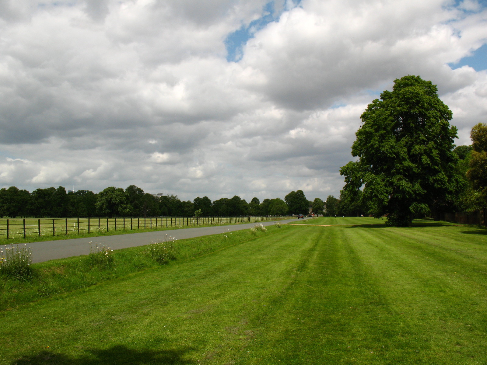
The Thames Path continues its route away from the Thames, passing through Syon
Park, the grounds of Syon House. The 80 hectare park includes tidal meadows and
over 200 species of tree. The park was the site of Syon Abbey from 1415,
dissolved by Henry VIII in 1539.
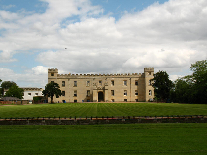
Syon House is the London residence of the Duke of Northumberland. It was built
between 1547 and 1552 in the Italian Renaissance style for its owner the 1st
Duke of Somerset, Lord Protector to young Edward VI. The interior was
extensively remodelled in the mid-18th century.
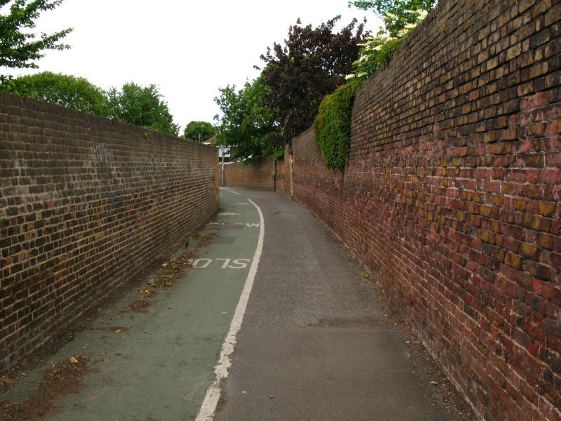
Rather confusingly, the route through Syon Park and along this alleyway is
marked as a byway on the Ordnance Survey's 1:25 000 and 1:50 000 maps, but has
gates which are locked at the southern end and here has notices banning
vehicles, both of which appear to be inconsistent with that status. Either the
landowners are taking liberties or the OS is wrong.
We emerged onto the A315 London Road, and reached the Grand Union Canal. There
we parted company with the Capital Ring, it going north-west to Osterley Lock,
and us going east along the canal towards the Thames - we had
already walked the next
bit of the Thames Path last month, albeit in the other direction.
To continue along the Capital Ring, click the walker above, otherwise continue
below for more along the Thames Path.
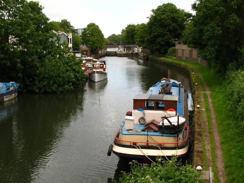
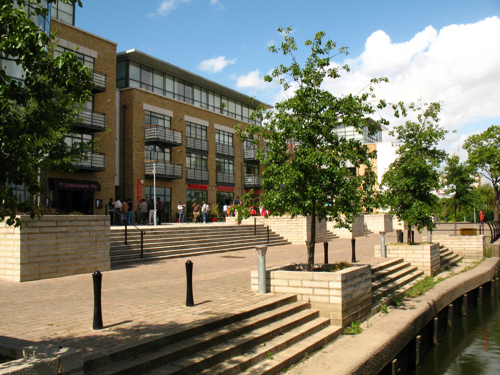
The Thames Path follows the Grand Union Canal, and here approaches Thames Locks.

Lots of people were out and about at this new riverside complex of offices,
flats, shops and restaurants.
Walking along the north bank of the Thames, there are lots of houseboats. Ahead
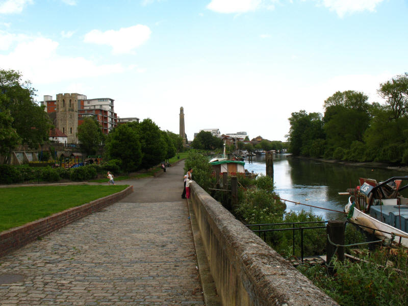
is the impressive tower of the Kew Bridge Steam Museum, where large engines once
pumped west London's water supply.
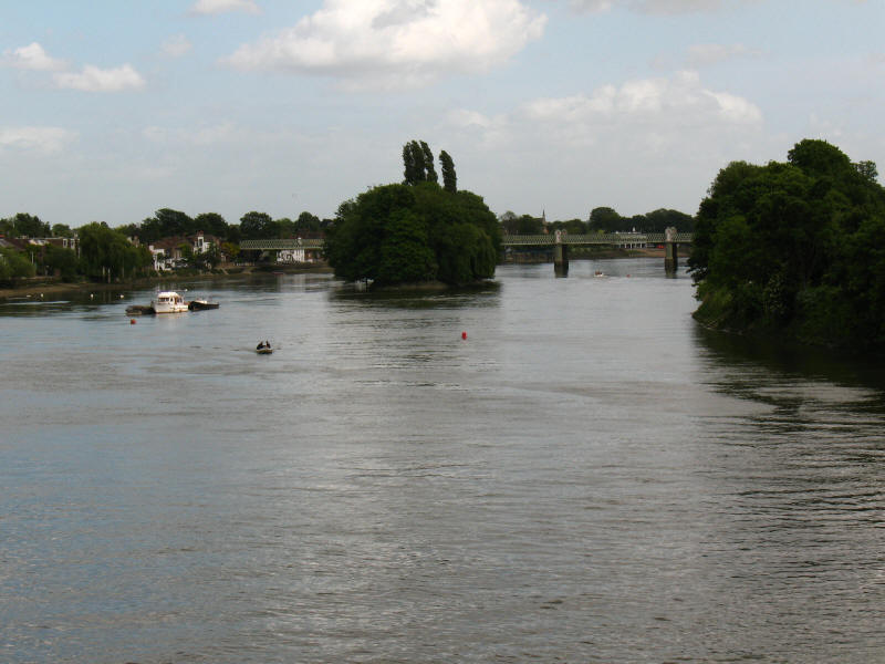
Nearly at journey's end as we cross Kew Bridge, looking downstream along the
Thames which has suddenly sprawled remarkably, to the Kew railway bridge.
Total including link walks to railway stations, 15.9 km (14.4 km on the Path), 4 hours 21 mins (including 55 mins stopped)
 

|