Buttermere Fells:
Seat, High Crag, High Stile, Red Pike and Dodd
2 January 2011
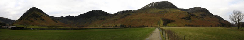
As predicted yesterday, today's walk is to the ridge of fells on the
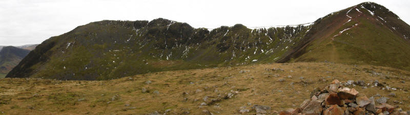
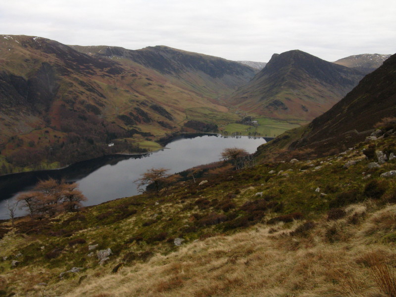
southwestern side of Buttermere. This picture shows Fleetwith Pike on
the left, then Haystacks before the pass of Scarth Gap which is our
first objective; then the minor summit of Seat before High Crag (which
appears highest from this angle), then High Stile (which is highest),
Red Pike (hidden from here) and Dodd, just poking out.
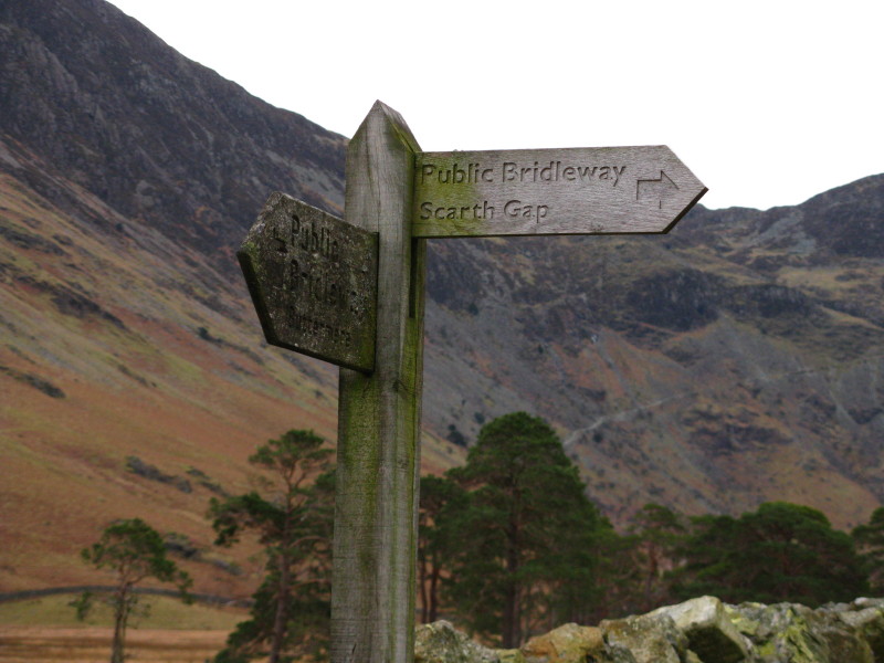
So, first objective Scarth Gap.
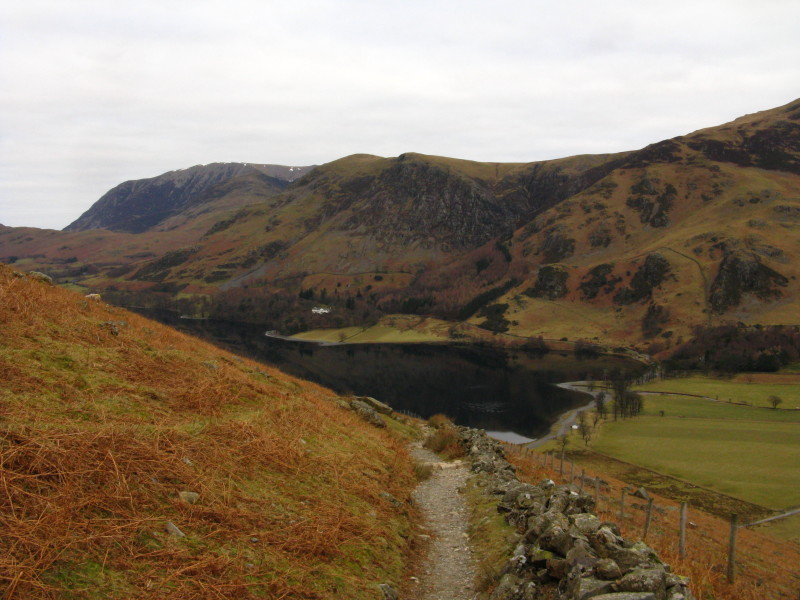
Ascending to Scarth Gap, a look back to part of Buttermere, with the
Grasmere massif starting to appear behind High Snockrigg (centre).
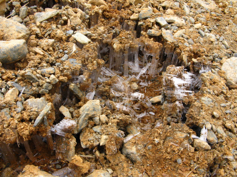
These formations were interesting - columnar ice crystals supporting
loose soil and pebbles. It appears as though the ice crystals have grown
up and lifted the loose surface, easily crushed by the first boot along.
The rising path to Scarth Gap (the notch in the skyline second from
left) pauses briefly on its pleasant and gentle ascent.
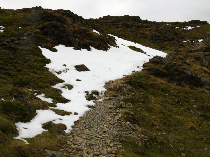
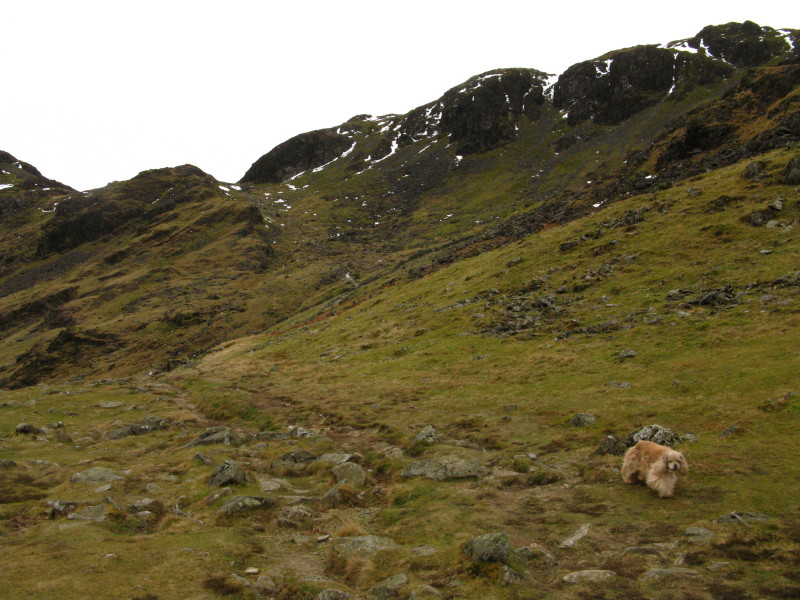
Ascending from Scarth Gap to Seat. An easy starter for today's Spot The
American Cocker (STAC) competition.
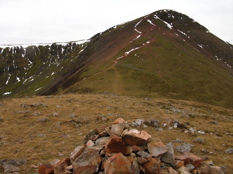
The cairn on the summit of Seat, with the steep ascent onto High Crag
showing.
Across Ennerdale to Pillar and Pillar Rock
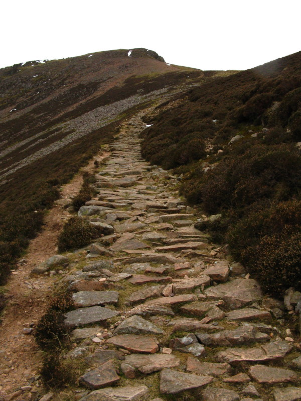
The route to High Crag (you can see the zig-zags to the left of a scree
run, some of them filled with snow). (STAC)
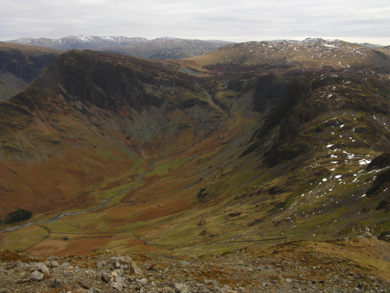
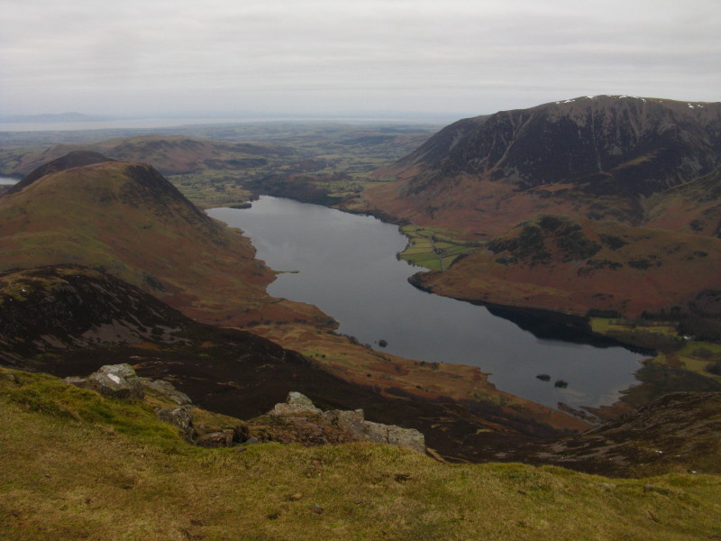
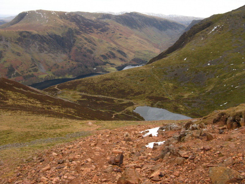
Warnscale Bottom from High Crag

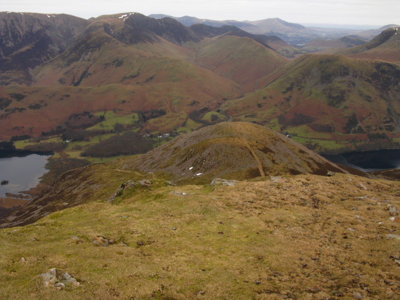
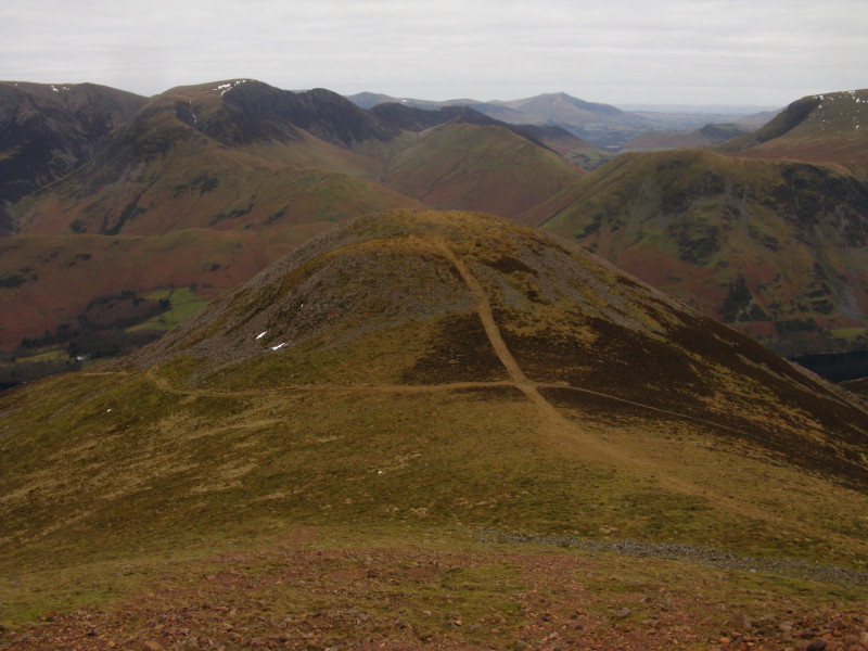
Looking over the summit of Seat to the head of Ennerdale, with
yesterday's Green Gable to the left of Great Gable.
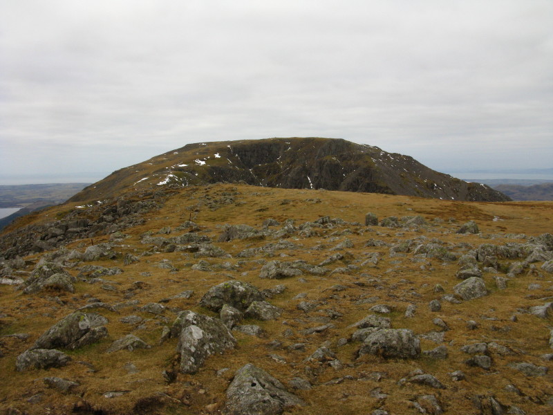
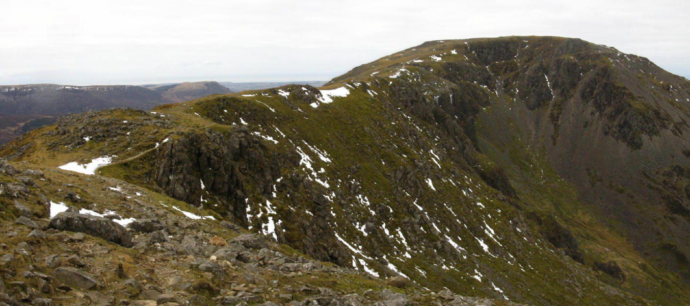
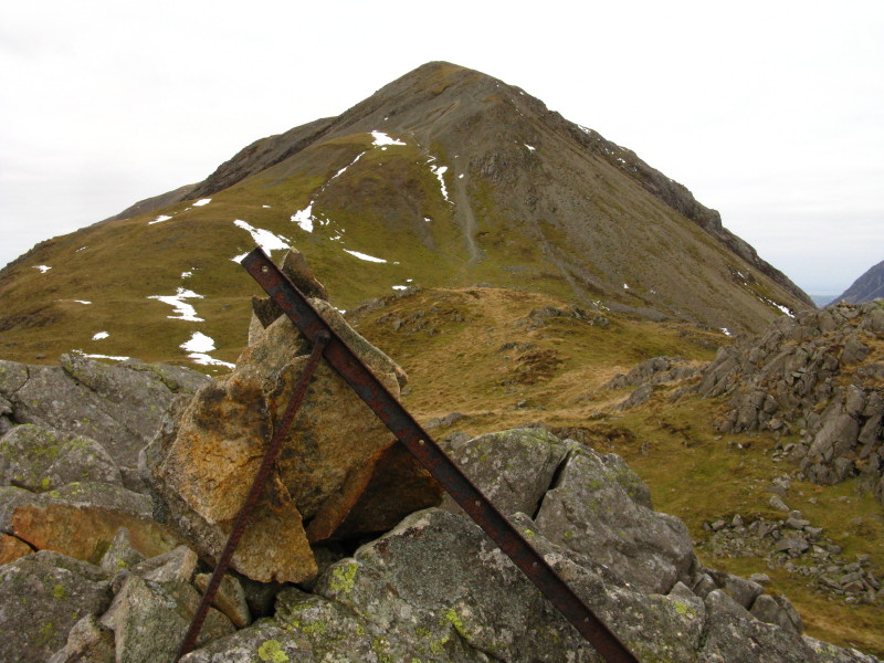
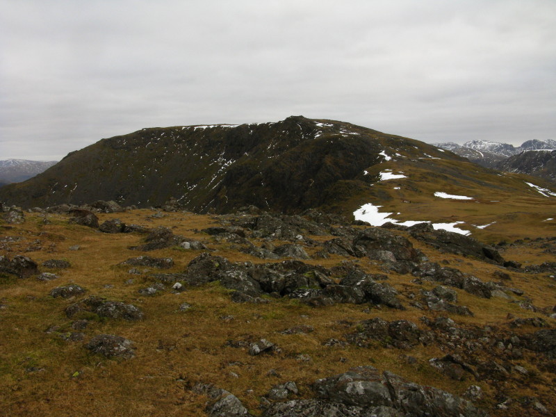
High Stile from High Crag.

The route above Comb Crags to High Stile. (STAC)
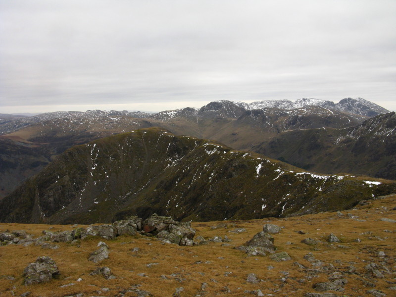
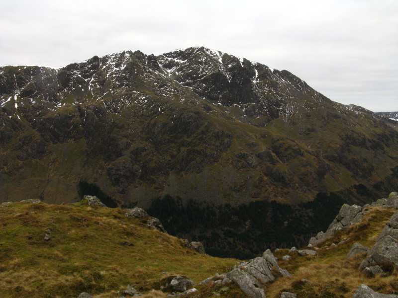
Later, looking back to High Crag from High Stile, with the Scafell range
(except Great End) now visible above the twin summits of Kirk Fell.
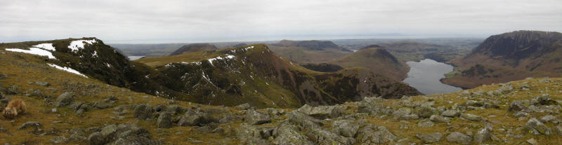
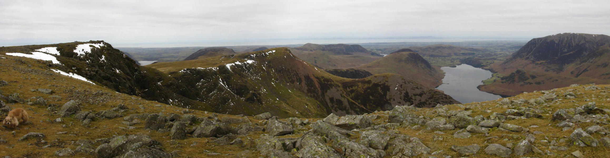
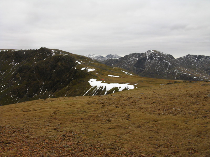
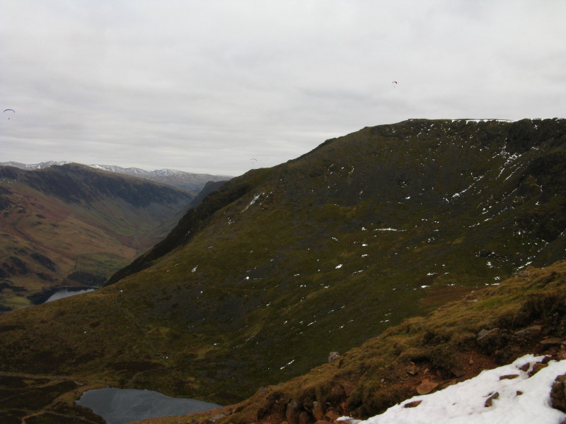
From the northern summit of High Stile, a look past the western summit
to Red Pike and the descent to Dodd. Beyond Crummock Water can be seen a
little of Loweswater, and on the left is a little of Ennerdale Water; a
hazy Scotland is visible beyond. The Isle of Man and Wales could also be
seen but didn't photograph well. (An easy STAC, but did you spot him
before being told he was there?)
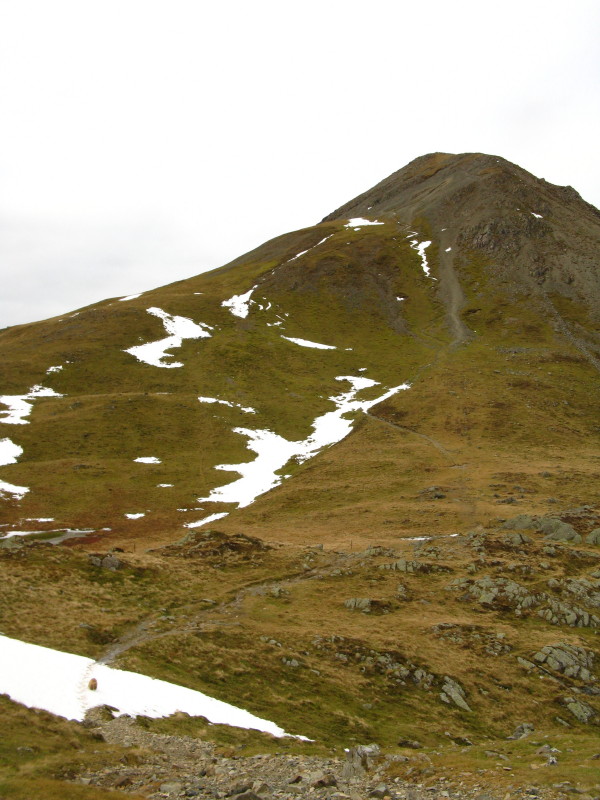
On Red Pike, a look back to High Stile.
Crummock Water again
Dodd from the summit of Red Pike.
Above Chapel Crags between us and High Stile are some interesting
developments
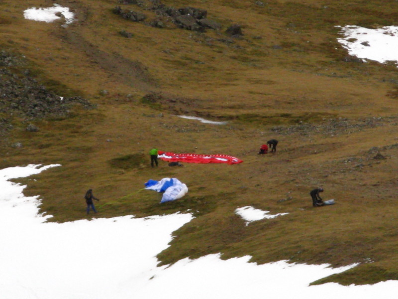
Zooming in, a slightly blurred picture of some parascenders getting
ready.
Looking down to Bleadberry Tarn as we make our way to Dodd. The descent
from Red Pike was described in Wainwright as difficult to negotiate, and
he was right, especially with quite a bit of snow and ice, but it was
simply a question of taking it very slowly and cautiously. But if ever
there is an example of a section of a path that needs repairing, this is
it. (A slightly more challenging STAC.)
Looking down to The Saddle from where it's a short and easy ascent to
Dodd.
The three parascenders enjoying their New Year's Day - until one of them
apparently landed in a tree, as I was later told by a chap I passed
coming up.
From Dodd, a view of High Stile, Chapel Crags and Red Pike.
A closer view of that steep and tricky descent.
Continuing the descent to Bleaberry Tarn, this section has been paved.
Of course I don't know what it was like before the work was done, but
this section is much less steep than that at the top, and so it seems
very surprising that it was tackled first. It's also been done quite
badly, in my view, with far too many small stones placed parallel to the
ground rather that with any horizontal surfaces. This makes the walking
difficult and slow, and when the stones are wet, dangerous. As a result,
you can see that large numbers of boots have trodden out an alternative
to the left of the route created at great effort and expense. The
solution is not to pile boulders along the edge to stop this happening,
as is done on some paths, but to make the paved paths, where they are
needed, easier to walk on. The bottom part of this path, through
Burtness Wood, is a great example of how to do it right.
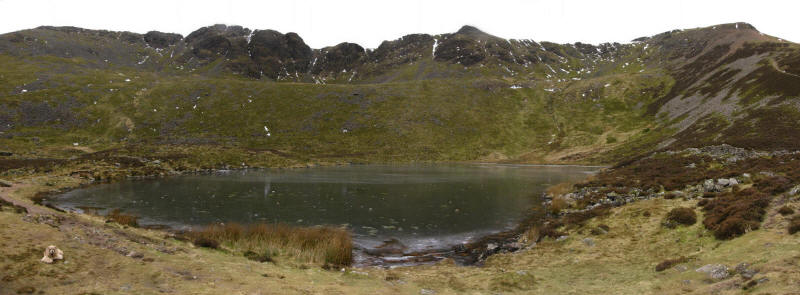
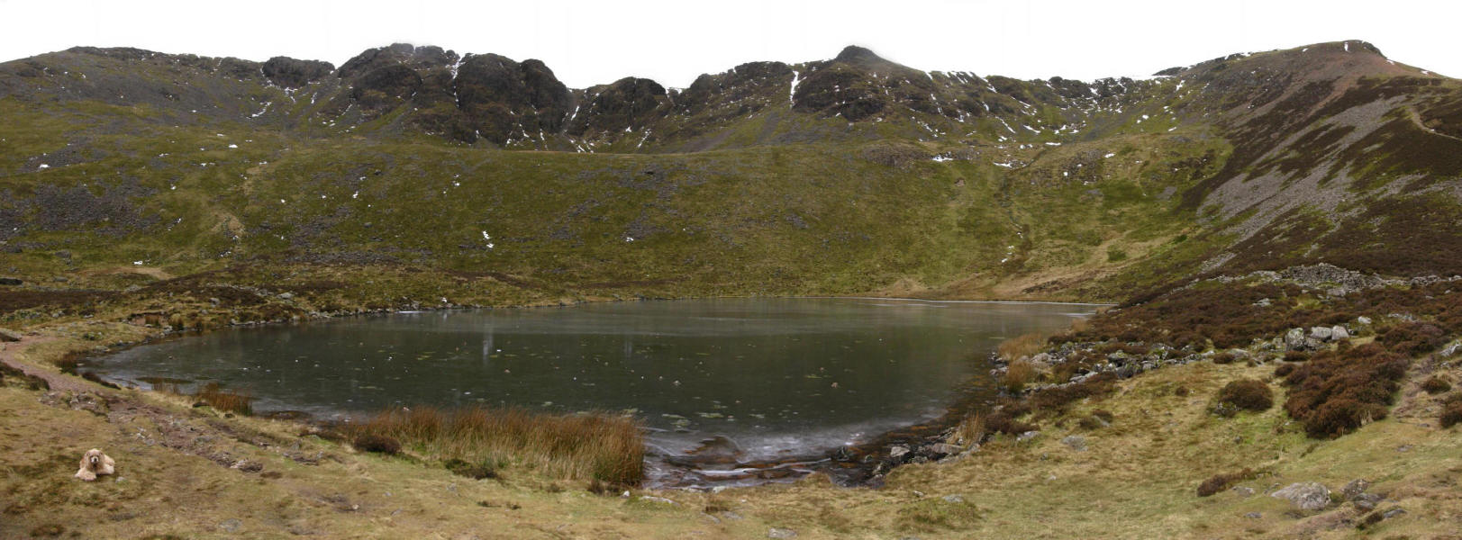
Bleaberry Tarn. (STAC)
Continuing the descent towards Buttermere, a few ragged trees remain
from an old planation. It's a shame that a few more scattered trees
can't be planted - it generally seems to be either a dense wood or open
fell, but isolated trees or small clusters on the fells can be very
attractive.
After a speedy descent through Burtness Wood on the excellent path,
we've reached the lakeshore path which will take us the length of
Buttermere and back to the car at Gatesgarth. There's a lovely
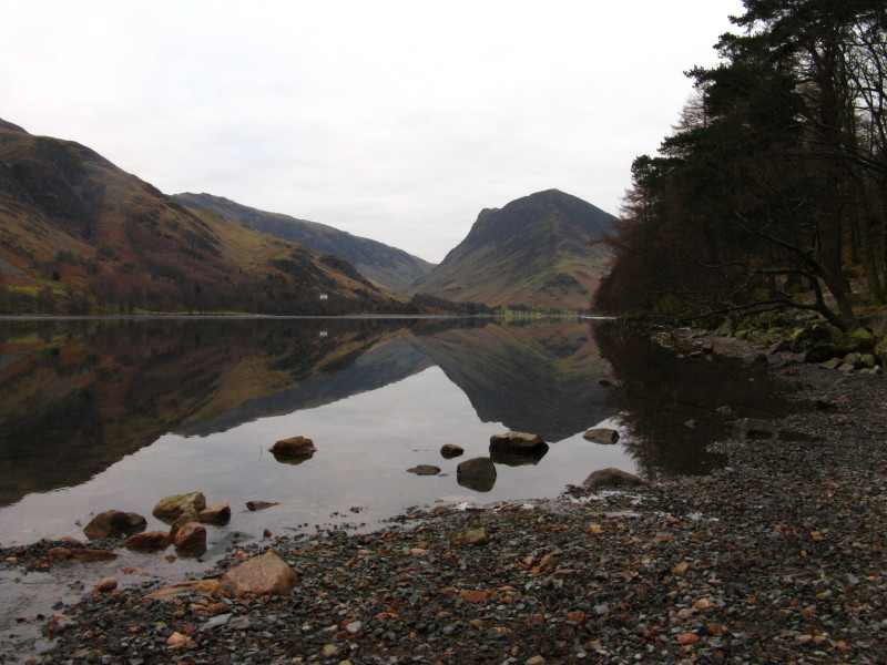
reflection of Fleetwith Pike.
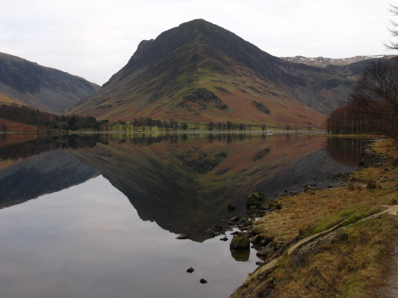
Another shot of Fleetwith Pike. That ridge route does look rather steep,
and I'm inclined to use the old mine road instead when I tackle this
one.
A very pleasant walk with some dramatic mountain scenery.
Total distance 12.7 km and 1099 metres of ascent in 5 hours 55 mins
Lake District holiday, New Year 2010/11
|
|