Peddars WayThe Peddars Way is 75 km long and follows the route of a Roman road, which may in turn have followed an ancient trackway forming a branch or extension of the Icknield Way. The name is said to be derived from the Latin pedester – on foot. It is first mentioned on a map of 1587 AD. It starts at Knettishall Heath in Suffolk (about 7 km/4 mi east of Thetford near the Norfolk-Suffolk border), and it links with the Norfolk Coast Path at Holme-next-the-Sea. Rather oddly, it is joined with the Norfolk Coast Path, a route entirely different in character, to form a single National Trail. One rather suspects a decision by committee working to tick enough boxes to satisfy pre-defined criteria - they don't even form a continuous length as the Norfolk Coast Path starts in Hunstanton, several kilometres to the south-west of the end of the Peddars Way, though it does pass the end of the latter. I've treated the two segments as two separate walks. My walks on the Peddars Way
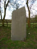
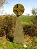
Total walked so far: 75 km - completed Stones of the Songline for Norfolk along the Peddars Way
Peddars Way links
|